
The Gulf Islands are the most visited boating destination on BC’s coast. They are accessible; lying within an easy cruise or sail for 80% of BC boaters. They are a short haul for Seattle boaters. With all their popularity, they still offer opportunities for hide-away anchorages. For the social boater and cultural explorer, the Islands cannot be surpassed. Convivial marinas, welcoming communities and distinct Island cultures await on Salt Spring, North and South Pender, Saturna, Mayne, Galiano, and Gabriola Islands. The Islands are rich in wildlife viewing and powerful natural settings. The fishing is good. What more can you ask for?
This guide to anchorages should be used in tandem with our searchable map. Our guide is not a substitute for large-scale charts and guidebooks and their use is absolutely necessary. Chart numbers refer to Canadian Hydrographic Service series. Coordinates are shown for anchorages with confined locations.
Note: The “Gulf Islands” are sometimes described as including Hornby and Denman Islands, and sometimes Quadra and Cortez Islands. The islands we include in this guide are often referred to as the Southern Gulf Islands.
Salt Spring Island
Salt Spring is the largest and most populated of the Gulf Islands. It has a handful of seaside villages. Ganges, located near the centre of the island, is a focal point for arts, restaurants and pubs, unique shops and bookstores, and the famous outdoor Saturday craft market. A public transport system connects most of the island.
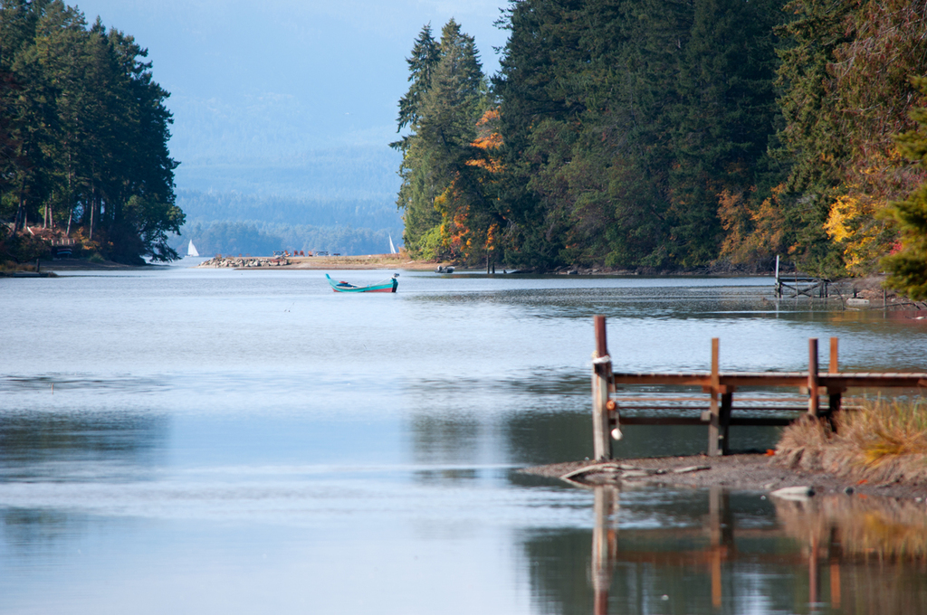
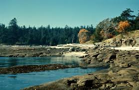
Portland Island — Chart 3476, 3441
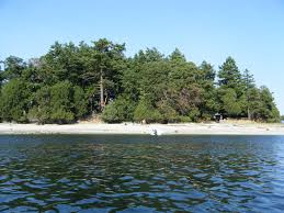
We include Portland Island here because it is close to Salt Spring Island. The little island offers protected anchorage at its north and south ends, and there are many other locations that are suitable in calm weather. The island is part of the GI National Park Reserve. Trails through forests and the remains of orchards criss-cross the island. There are campsites at Princess Bay, on the W shore across from Brackman Island and on the NE peninsula called Arbutus Point. Many of the small neighbouring islands are privately owned. BC’s first artificial reef, the sunken freighter G.B. Church, is situated off the northeast shore of Portland Island. The scuttled ship now serves as a haven for marine organisms and is an attraction for divers from around the world. Princess Bay, at the south end, is the largest and most used safe haven, comfortable in most moderate weather, but exposed to the SE. Somewhat exposed to ferry wash. Enter close and N of the Tortoise Islets. Entry from the south should not be attempted except at high water. The Bay has lots of room, but when it is crowded it is advised to tie to the metal rings on the shoreline. Anchor in 5 m depth in mud and shell. There is a small dinghy dock on the W shore. Royal Cove is sheltered from the S and moderately from the N, but is subject to strong ferry wakes from traffic in Satellite Channel. Anchorage is limited to 6-8 boats and stern tying is strongly recommended. The cove is sheltered by Chads Island (private), but plan your cooking to be between ferries. A dinghy dock that dries out at low tide, a toilet, and an information sign are also located here, and Arbutus Point is only a half a kilometre away on a good trail. Enter the Cove from the NE avoiding a reef jutting out from Chad Island. Depths are 4-6 m and holding is good in mud.
Isabella Island — Chart 3478 | 48.44 N 123.26 W
Isabella Island and Jackson Rock 48.45 N 123.26 W) are two tiny, fair-weather havens for those seeking a day or over-night of relative solitude. There are a few unmarked buoys for tying up at Isabella Island, in 2-4 metres with good holding in sand and mud. A stern line is recommended to secure against ferry wash. Jackson Rock is an intriguing kayak locale and there is a hiking trail on the shore. The land belongs to the Tsawout First Nation, which allows visitors access. Anchor between the large (Jackson) rock and Salt Spring Island in 6 m with good holding in mud and sand.

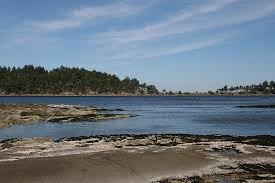
Russell Island — Chart 3441 | 48.46 N 123.23 W
Russell Island stands off the entrance to Fulford Harbour. The little island is an ecological treasure house with pocket shell beaches and old-growth forests with massive arbutus, which are connected by a circular trail. An old homestead, a monument to mixed Hawaiian-Indigenous heritage, sits among orchards planted more than a century ago. There is room for about a dozen boats on the NW aspect. The National Park Service provides a dinghy dock. Anchor in 5-10 metres over rock and gravel. Well protected from all directions except N. Fulford Harbour is close by with a number of amenities including a bakery and small grocery store.
Booth Bay — Chart 3442 | 48.52 N 123.33 W
This is a lovely over-night spot for a boat or two, but only in calm weather and never with a NW swell. The highlight is glorious, long sunsets. Baker Beach is one of the Island’s finest. The inlet extends 1.5 km and gives you a view into the residential mosaic on this idyllic isle. Anchor in 5 m over good-holding sand and gravel just off from the entrance to the inlet.

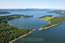
Glenthorne Passage, Prevost Island — Chart 3478, 3442
There are seven anchorages on Prevost Island. Many think Glenthorne Passage is the most remarkable. It offers excellent protection even in unsettled weather. During the long days of summer the Passage points at the sunset. The protected waters are ideal for paddle-boarding and kayaking. All surrounding islands and Prevost Island are private property, so you can look but not touch. Enter the Passage between Glenthorne Point and tiny Owl Island. There is good holding in 4-6 m in mud throughout the Passage.
Pender Island
North and South Pender Islands are separated by a navigable channel and are joined by a bridge. There are marinas at the north (Otter Bay), mid-point (Port Browning) and southern end (Poet’s Cove). All three provide dining and amenities, but shopping on these islands requires road travel. Driftwood Centre on Canal Road on North Pender has gas, groceries, liquor and cafes. Port Browning Resort and Marina on the north island has good food and lively entertainment.
Port Washington, Grimmer Bay — Chart 3442 | 49.49 N 123.19 W
Port Washington is located at the north-west tip of North Pender Island. Approach from Swanson Channel, N of Boat Islet. Aim for the wharfhead while keeping watch for a submerged rock about 50 m S of the wharfhead. The Bay offers protection from all directions except W and it is exposed to ferry wash. Anchorage is at the SE of the Bay, but the bottom is spotty and ferry wash intermittent. You may tie up at the float on the N side of the wharfhead. There is a charm to this old settlement. Unfortunately, the general store built in 1910 has been demolished. There is a general store 3 km from the Port and a taxi or hitching a ride will get you there.
Medicine Beach, Bedwell Harbour — Chart 3477 | 48.46 N 123.16 W
This well protected spot is about as serene as you will find on the Penders. The shell midden above the gravel beach is testimony to millennia of habitation. Medicine Beach Bird Sanctuary is behind Medicine Beach and contains rare plants. Walk softly and restrain pooches (best to not bring them). The sanctuary is one of only a few saltwater marshes left in the area. The beach is a wide crescent with long walks possible. There are cliffs at the north end of the beach with stairs to a viewing platform. From there it is a short hike to a convenience store and café with free wi-fi. So, here is a place you can get away and stay connected, if you desire. Anchor in front of the beach in 4-5 m with good holding in mud and gravel.

Shark Cove — Chart 3477 | 48.46 N 123.15 W
This cozy cove is minutes from Medicine Beach via the Pender Canal. Canal depth is 2 m at LW and has modest currents when the tide is running. The bridge over the canal has an 8 m clearance at slack water. Entry into the Cove from N is unobstructed. Protected in all weather, but a bit of a through-fare with frequent wake disturbance. Mortimer Spit offers plenty of room to stretch the legs and is a lovely picnic spot. There are homes around the cove. The best anchorage is off of them on the W side of the cove, out of the passage route. Depths of 4-5 m in good-holding mud.
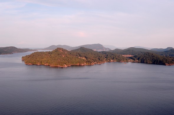
Saturna Island
There are no marinas on Saturna. There are many safe anchorages. This sparsely populated island has plenty to offer for nature lovers. Carefully explore tide pools to view starfish and small marine creatures, or join a guided kayak tour to spot larger marine life, including whales, otters, seals and more. A large portion of Saturna Island is protected by the Gulf Islands Marine Park Reserve and the island is renowned for adventurous hiking, boating, kayaking, back country camping, wildlife viewing, breathtaking viewpoints including Mt. Warburton Pike (the highest peak in the park reserve) and spectacular shorelines to explore.
Narvaez Bay — Chart 3477 | 48.77 N, -123.10 W
Most of the Bay is surrounded by steep shores and the GI Park Reserve. There are several locations for landing a dinghy and maintained hiking trails take you to viewpoints. There is temporary anchorage near the head and room for a few over-night boats in the cove behind the anvil-shaped peninsula on the S shore near the entrance. A great spot when the westerlies and north-westerlies blow, it is exposed to anything coming from the E. Depths are 4-6. The bottom is unstable and so a stern line is recommended. Narvaez Bay Campsite is near this little cove. The site is remarkable for rugged shorelines and a rare arbutus-Garry Oak forest.
Tumbo Island and Cabbage Island — Chart 3441
This islands and sandbars complex has an exposed feel and offers sunrises and sunsets. A shoreline walk around little Cabbage Island is possible at low water. Tumbo Island has a trail from point to point E-W, and a circular trail through meadows around a rare freshwater marsh. Excellent views from Tumbo Point and Savage Point. There are ample beaches. Reef Harbour is the most popular and protected anchorage. Enter from Tumbo Channel, giving rocks off Reef Harbour Point a wide berth. Depths of 3-8 m with good holding in sand and gravel. When the weather is westerly, Georges Bay is an alternative, but should be avoided in any other wind direction. There are rocks and reefs extending along both sides of the passage in. Aim for the centre of the beach and anchor in 4-8 m with good holding in sand and gravel.
Winter Cove — Chart 3477 | 48.48 N 123.11 W
Framed by Samuel and Saturna Islands, this is a popular, safe-in-most-weather cove with fine sunrises and sunsets. It is road-accessed and there is a boat launch, making it a popular and sociable spot. The cove is lined with beaches, but the approaches are shallow. Depths are rarely more than 4 m, and there are sand bars and an exposed rock in the centre. Shallow, protected water makes this one of the warmest swims on the Coast. A circular trail begins at the picnic area and traverses a Douglas Fir forest, passes beside two saltwater marshes then out onto rocks along the shoreline on Winter Point. At low tide, jagged reefs are exposed along the Saturna shore. Entry via Boat Passage from the Salish Sea is challenging and should only be made at slack water. An S-turn around two exposed rocks is required. Entry from Plumber Sound is unimpeded.
Galiano Island
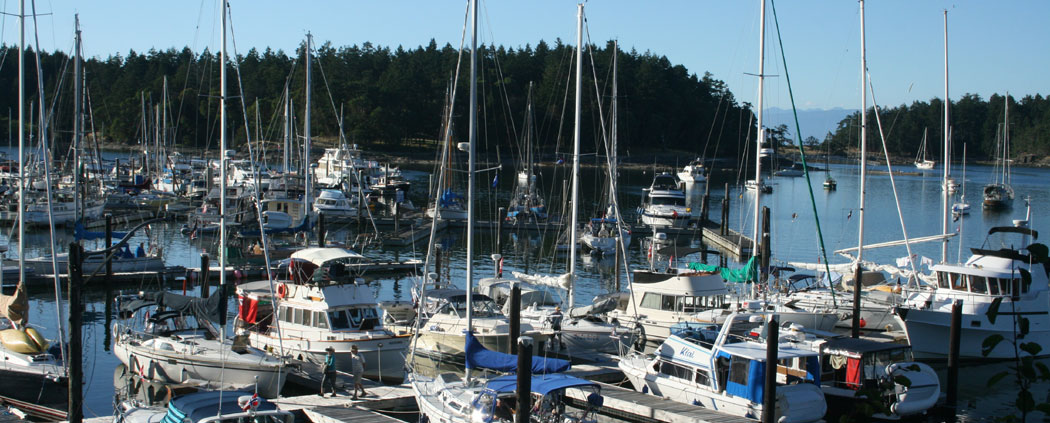
Home to several natural parks and recreation areas, this rugged island is ideal for active adventurers. Follow the island’s forested hiking and biking trails, or explore the coastline with a kayak. Dionisio Point Provincial Park is a popular place to swim, hike and explore tide pools. If you enjoy a rigorous bike ride, the trip from Montague Harbour to Dionisio Point is a rollercoaster of steep, short hills. Sturdies Bay has a public wharf. Sturdies Village is a short walk away. There you can find provisions, shopping and good food. While ashore, sample the extraordinary array of galleries on the Galiano Art Studio Tour. Enjoy fine West Coast cuisine at Galiano Oceanfront Inn and Spa or French homestyle dining at Le Berengerie. Whaler Bay Harbour Authority and Montague Harbour Marina are the only other moorages. The latter offers snug anchorage and best sunsets.
Montague Harbour Marine Park — Chart 3473 | 48.54 N 123.24 W
This is a very popular spot and for good reason. There is ample room for many boats, 35 mooring buoys and a dinghy dock. The walk-in campsites above the anchorage are amply spaced and have spectacular views from a bluff above a beach. On the west side of the park, near the boat launch, lie on the beach in the upper branches of an arbutus growing atop the bluff, but bent over the beach. That is where you will see what surely contest for the best sunsets on earth. The Park operates a floating nature centre featuring sea life. A 7-kilometre hiking trail leads you through forest, across beaches and beside a tidal lagoon. It is a short ride by tender to Montague Harbour Marina, with store and restaurant. For an unforgettable experience, ride with Tommy Transit on the shuttle bus to Hummingbird Pub. The food is good, but it is the ride you will never forget. Entrances are from the NW and SE. Holding is good in mud.
Gabriola Island
The most northern of the Gulf Islands, Gabriola’s two marinas are a popular alternative to nearby Nanaimo’s lively waterfront. Pages Resort and Marina and Silva Bay Resort and Marina offer berths and an array of comforts. The Island has few natural anchorages, which is why we include nearby Herring Bay on Ruxton Island. Gabriola has several provincial parks and many enjoyable beaches, providing lots of places to explore. Don’t miss the Malaspina Galleries, which are beautiful wave-like sandstone formations that were created by millennia of water erosion. Take advantage of dive charters, fishing charters, kayak rentals or golf in seaside splendor at Gabriola Golf and Country Club. If you brought a bike, you may visit the many studios, farm tours and beaches on a circle route. Or, rent a scooter at Pages Resort.
Herring Bay, Ruxton Island — Chart 3475 | 49.05 N 123.43 W
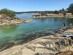
Herring Bay is at the NW tip of Ruxton Island. Among its many attractions is varied and abundant wildlife, including a resident seal population, otters, eagles and many shorebirds. It is surrounded by marvellously sculpted sandstone ledges, with a sprinkle of beaches. Herring Bay is renowned for clear, warm water; a snorkler’s dream. There is room for half-a-dozen boats in 4-6 m with good holding. Enter between the sandstone islets and the day marker on the NW end, staying close to the centre of the channel. Best anchorage is to the SE between the two fingers of Ruxton Island. The Bay is exposed to NW and SW winds and is a fair-weather anchorage.
Drumbeg Provinical Park and Kendrick Island — Chart 3475 | 40.08 N 123.42 W
These two locations are a tactical pairing because the Drumbeg location is protected from the NW, while the Kendrick Island location is secure from the S and SE. The park contains a kilometre-long sand and pebble beach with sculpted sandstone ledges, visible at low tide. A trail accessible from the beach follows the shoreline in two directions. There is room for three boats off the beach with good holding in 4-5 m in sand. Across Gabriola Passage, the long, narrow inlet between Valdes and Kendrick Islands has room for half-a-dozen vessels, with good holding in 6-9 m in sand and mud. Stay to the centre of the channel. West Vancouver Yacht Club has a float attached to Kendrick Island.
Taylor Bay and Pilot Bay — Chart 3458 | 49.12 N 123.52 W
At the least this should be a day-stop on your tour of the Gulf Islands. Each bay has one of the best beaches in the Islands. The renowned Malaspina Galleries can be viewed by kayak or tender, or on foot at LW. Elsewhere, there is ample room to walk the rocky shoreline with its numerous tide pools. The two sandy beaches form an isthmus that divides the Bays and provides vital ecosystems for migratory and breeding shorebirds. This is Gabriola Sands Provincial Park; road-accessible and a popular destination for kayakers. Anchor in either Bay as snug to the beaches as you can in 2-6 m with good holding in sand. Taylor Bay is exposed to the W and N and to ferry wash. Pilot Bay is protected from all but NE winds, but is open to the swell from the Salish Sea.