
Rugged Shores and Sheltered Routes
The Northern Passages region is north of Douglas Channel and the south end of Banks and Pitt Islands, and extends to the Alaska border. Many people consider this region part of the Great Bear Rainforest. Call it what you like, the sounds of the sea, the near silence of the rainforests, rugged shores and sheltered routes continue in the Northern Passages. Of course, you are still in prime fishing waters, where mighty rivers feed the sea.
Rods up, boys, credit Tourism Prince Rupert 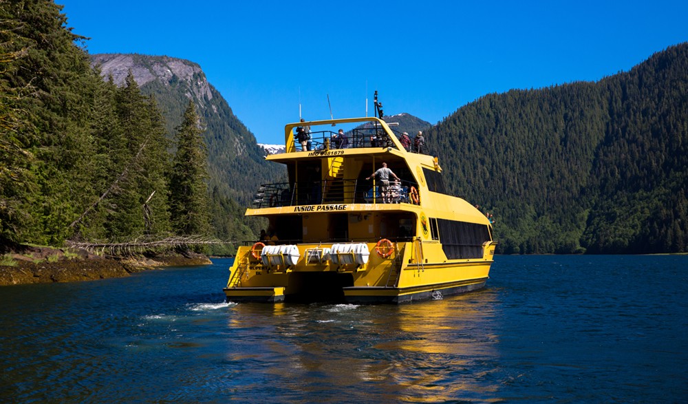
Cruising the Inside Passage, credit Tourism Prince Rupert
Refit and go wild again
Paradoxically, as you explore northward, you return to points of considerable settlement. Prince Rupert, a major town and marine centre, is near the middle of this region. Prince Rupert is at the end of Highway 16, which connects to British Columbia and Alberta highway systems. That is why many boaters keep their vessel year round in Prince Rupert and Port Edward, or tow their boat and put in here. From these ports, Haida Gwaii, Great Bear Rainforest and Broughton Archipelago are much short voyages than from southern ports. The route from Vancouver takes at least two weeks, but better to take a month or more. Prince Rupert and Port Edward are frequent stops for those enroute to and from Alaska. It is a good thing they are there, because no matter what direction you have come from, your supplies are dwindling.
Explore Northern Passages
Hartley Bay (Kulkayu) sits near the wide entrance to Douglas Channel. The community is on the main route to Alaska and pretty much a necessary stop. This is the home of the Gitga’at First Nation, which means “People of the Cane.” The Gitga’at are members of the Tsimshian nation.. It is a welcome stop for fuel and land rest. Hartley Bay Fuels and Marina sells marine gas and diesel and provides moorage for about 40 boats, although availability is very limited, as are food and other necessities. Coghlan Anchorage is an alternative to mooring in Hartley Bay. It is southwest via Stewart Narrows (53 23.9 N 129 17.0 W), tucked behind Promise Island, with mooring buoys.
Douglas Channel penetrates the Coast Mountains for over 100 km (60 miles). Mountains tower on both sides and as always here you share the water with abundant sea life. Three hot springs in Marine Parks line the way. Bishop Bay-Monkey Reach has a bathhouse, dock, mooring buoys and primitive facilities. Further up the Channel is Weewanie Hot Springs Park which has a bathhouse, mooring buoy and primitive facilities. Shearwater Hots Springs Conservancy (a.k.a. Europa HS) is about half-way down Gardner Channel. It too has mooring buoys and a bathhouse. (Follow links to find maps of locations). MK Bay Marina is your host in Kitimat.
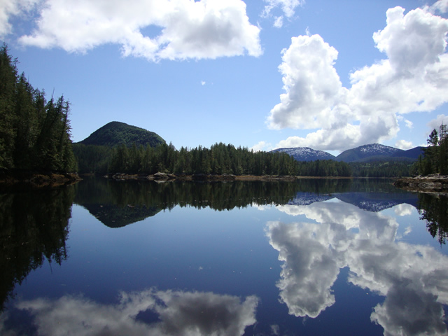
tranquility in Union Passage Marine Park 
spirit bear Khutzeymateen, credit Yellowfin Adventures

If you are inspired to penetrate the continent even more, then Gardner Canal admits you an additional 100 km to Huchsduwachsdu Nuyem Jees (Source of Milky Blue Waters) known now as Kitilope Heritage Conservancy, the largest area of protected coastal temperate rainforest in the world. You will be dwarfed and exhilarated every minute you venture deeper into the mountains, the channel narrowing until fresh water mixes with salt. There is a marina and all services in Kitimat.

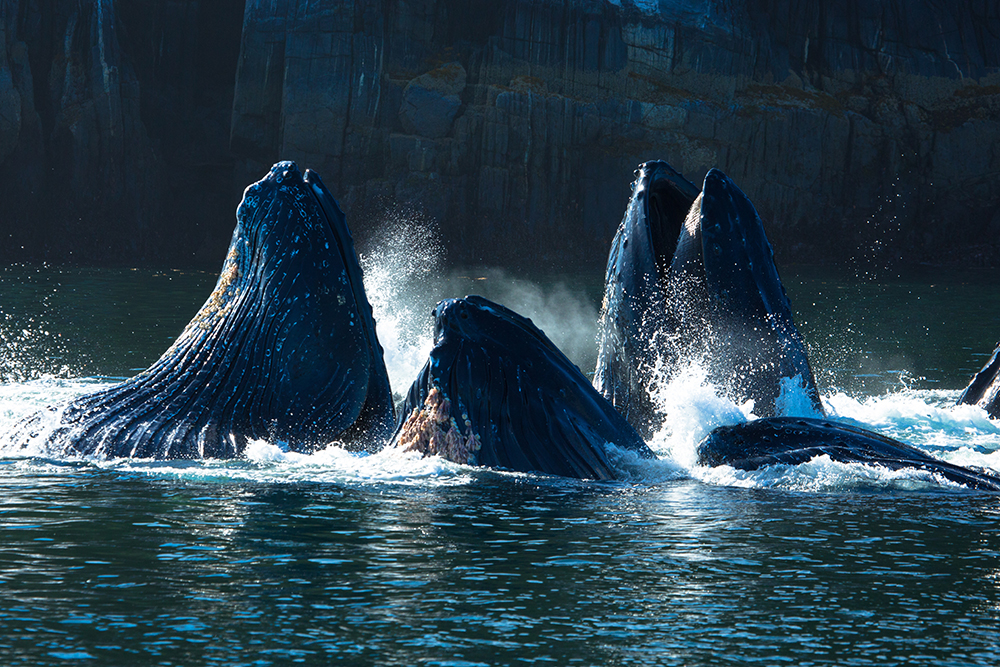
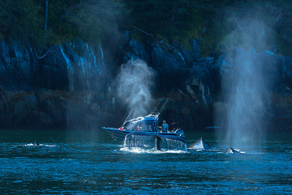
Unforgettable sights. Head north in the early summer to the beautiful mouth of the Work Channel, just north of Prince Rupert. Drop your line for a chance at catching a giant Skeena River Chinook, and keep your eyes open to catch a glimpse of the incredible “bubble nets” created by Humpback Whales to help them trap and catch fish themselves.
Optional Routes
There are no marinas or communities along any of these routes, until you reach Port Edward and Prince Rupert.
Travelling north, you may choose Grenville Channel, the narrow and popular Inside Passage route, east of Pitt Island. This is the route used by BC Ferries and other commercial traffic. It is sheltered and the living shores are close at hand. At the base of the Channel Union Passage Marine Park lies between Pitt and Farrant Islands. Inside you will have tranquil waters, abundant wildlife and stunning surroundings to yourself. Mind the tidal currents entering from either SE or NW.
There are four commonly used anchorages in Grenville Channel. Heading north, the first is Nettle Basin in Lowe Inlet Marine Park (entrance 53 32.4 N 129 36.1 W). Verney Falls will serenade you softly as you sleep at anchor. There are shallows near the falls, so anchor out a bit, or nestle in the bay to the east of the falls, but account for large tidal changes. Klewnuggit Inlet Marine Park is well-protected, but deep. Follow the East Basin to a small appendage to the northwest. Depth is 16 m, hold is solid. Next along the Channel north is Baker Inlet. Again, tight passage at its mouth and strong tidal currents. Anchor just inside the mouth or in a shallow bay in the mid-point of the Inlet on the south side. Nearby is Kumealon Inlet. Well protected with best anchorage in the eastern corner. Proceed with caution around small islands and shoals that guard the inner basin. The lagoon to the northwest is a delight for kayakers, but the entrance is subject to strong currents.
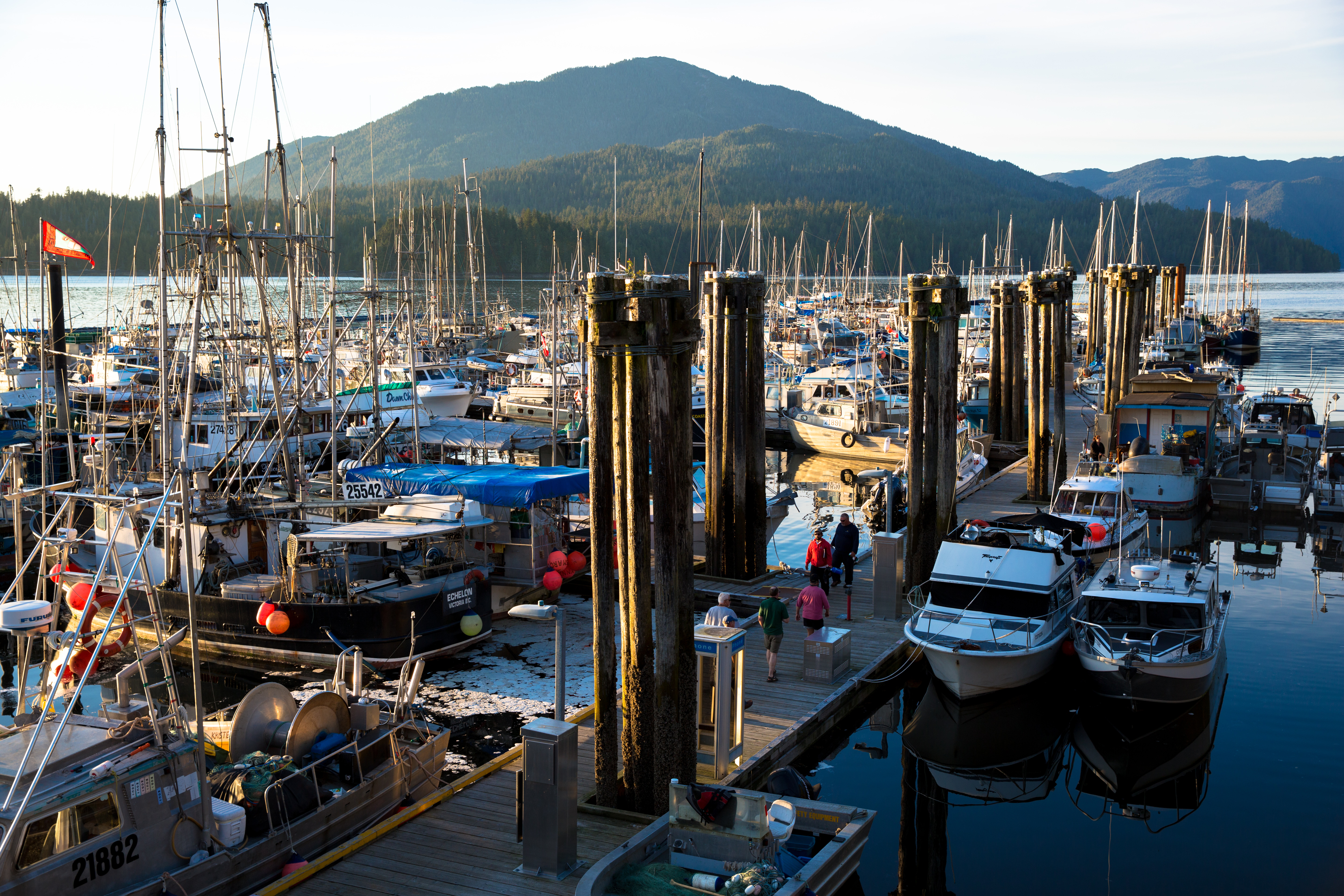
Prince Rupert hospitality is at your dock, credit Destination BC/JF Bergeron 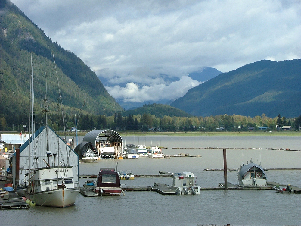
Marina in Stewart
A second option is Principe Channel, outside Pitt Island and inside Banks Island as far as McCauley Island, and then take the Ala Passage between McCauley and Pitt Islands. This route is more exposed to weather and should only be taken when conditions are stable. The reward is solitude and plentiful beckoning inlets where you can smell, hear and taste the freshness of the natural world. We recommend you avoid the outside passage in open Hecate Strait. It is considered one of the most dangerous water on earth.
All routes lead to Porcher Island where three small settlements established in the early 20th century still boast a few inhabitants. These settlements are found at Hunts Inlet and at Humpback Bay, both on the island’s northernmost tip, and at Oona River, which flows into Ogden Channel at the island’s eastern edge. Canneries, wooden ship-building and Scandinavian pioneers are part of the history.
Civilization . . . briefly
The wide Skeena River enters the sea here. It is navigable for about 60 km (40 miles). Little, big-hearted Port Edward is located near its mouth. Port Edward Harbour Authority offers moorage and many services at four locations. Stroll through this tidy community and visit the North Pacific Historic Fishing Village.
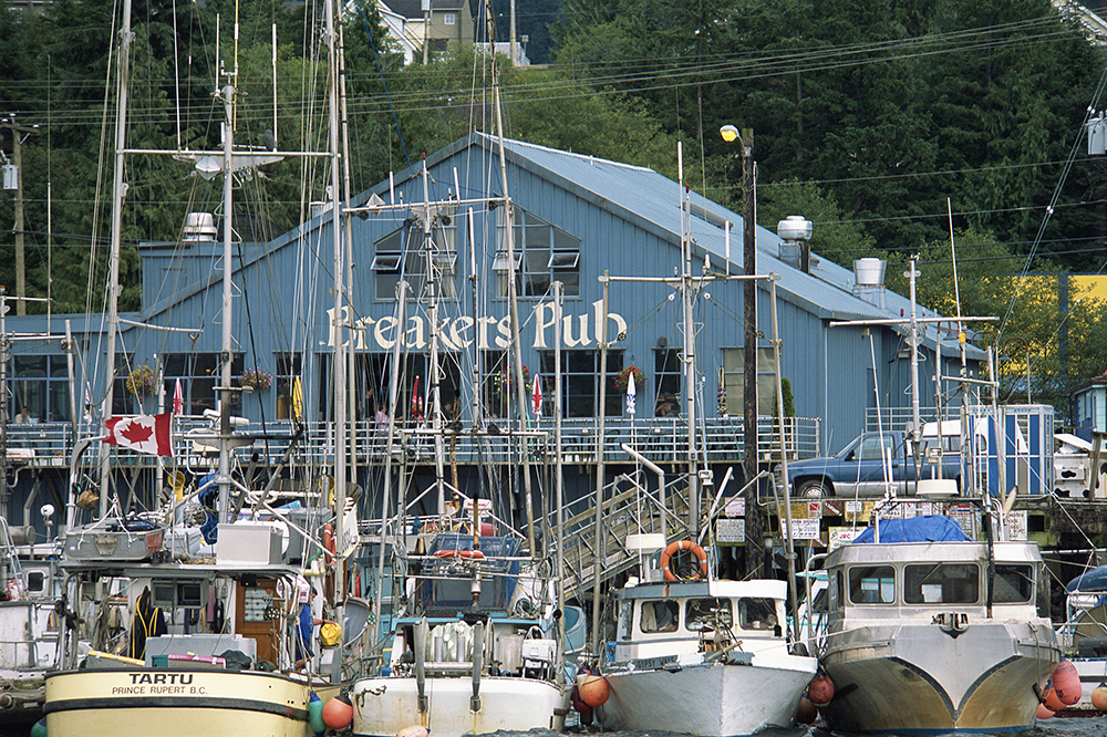
You have been at sea for some time now. Visit the Prince Rupert page under Chart Your Course-Communities to find dining, activities and shopping. Prince Rupert is the largest community on the BC mainland coast north of Howe Sound. You will find everything a boater needs, and moorage is usually available due to expansion in 2015 of Cow Bay Marina. The magnificent Northwest Coast longhouse overlooking Prince Rupert Harbour is home to the Museum of Northern BC. The Museum draws visitors from around the world to experience its unique celebration of cultures and histories.
This rock’s taken, credit Destination BC/Tom Ryan 
Busy dock at Port Edward, credit Tourism Prince Rupert
For those who simply must go to the end of the “road” Stewart is an irresistible prize. The route lies up Hecate Strait, which is somewhat exposed, to Portland Canal. Steward is at the top, 100 nautical miles up an ocean river framed by glaciers. This is one of the best places to view grizzly bears and the fishing is unbeatable. Stewart could be the set for an old time movie. There are three year-round accommodations to choose from: an eclectic and historic inn, a hotel/motel and a cozy bed and breakfast. Stewart Harbour Authority, the most northern port on the BC coast, will make room for just about any size boat, including Al Pacino’s 120-foot yacht.
Along the way, take a side trip up long, lonely Work Channel. Or take the channel south of Somerville Island up a branch of Portland Inlet to Khutzeymateen Grizzly Bear Sanctuary, the first region in Canada to be protected specifically for grizzly bears and their habitat. It also represents the first undisturbed estuary of its size to be protected along the north coast of BC. The topography of this land and marine sanctuary is diverse, with rugged peaks towering to 2100 metres (6500 feet) above a valley of wetlands, old growth temperate rainforests and a large estuary. No need to tell you that wildlife abounds. The BC Parks wardens stationed here will give you an orientation before entering the Sanctuary.
We hate to say goodbye
Your route northward through Canadian waters may be taking you to Alaska. We can save you the trouble. It doesn’t get any better than this. Seriously, we hope you created lasting memories of your exploration of BC’s coast and we wish you well on your exploration of Alaska’s coastline. We welcome visitors from Alaska. And the best part of it all? You are probably coming back this way. Try another route or visit the places you missed on the outward journey. It will be nice to see you again.