
Land of the Spirit Bear
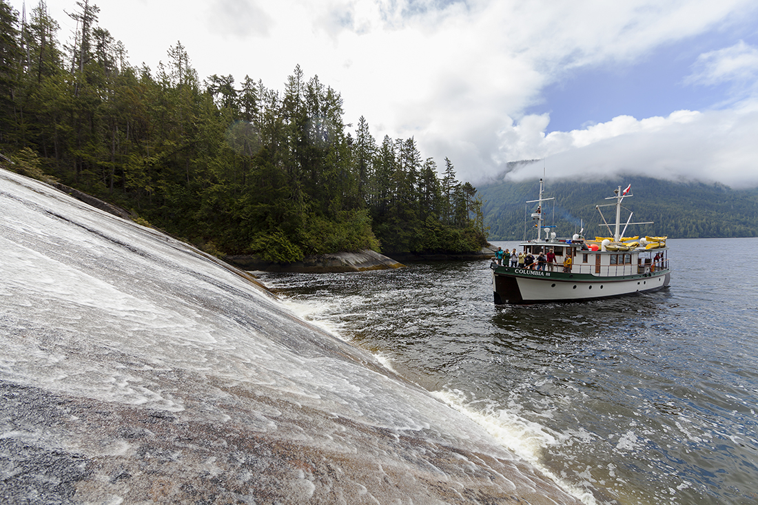
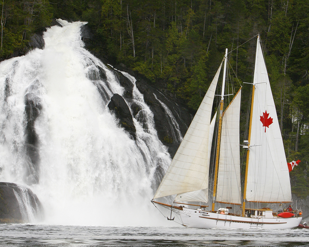
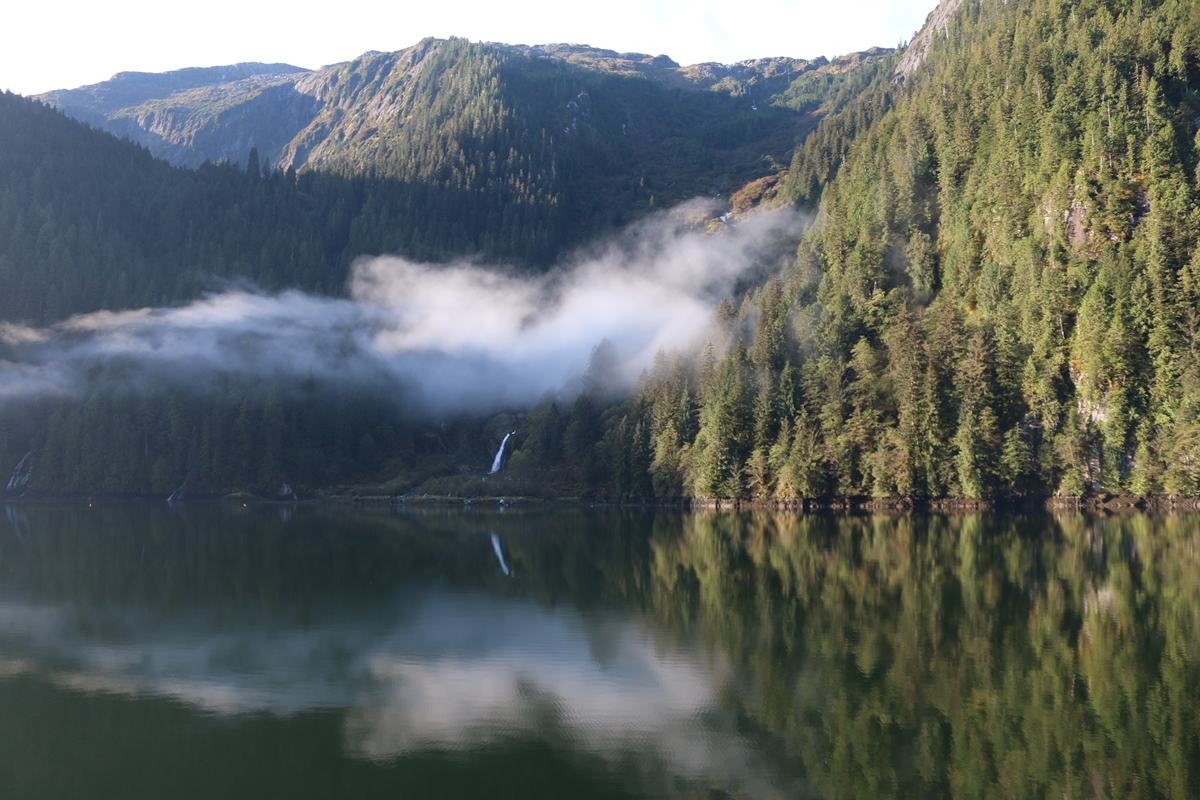
From Cape Caution to Hartley Bay stretches one of the planet’s last great wild places: the Great Bear Rainforest. Here, fjords snake through mountains that rise from the sea, waterfalls cascading down their shoulders. To the west, thousands of islands break the Pacific’s swell, and create protected channels that run through the world’s largest expanse of coastal temperate rainforest.
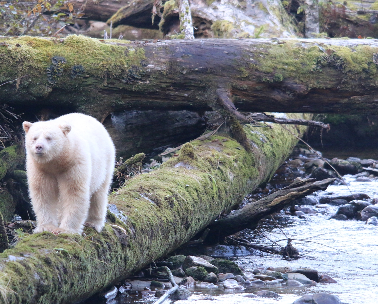
Healthy, wild populations of grizzly bears, coastal wolves, black bears and the rare white Spirit Bear roam this land in abundance. In the ocean, baleen and toothed whales as well as millions of seabirds feed on the abundant fish and krill in the cold, green coastal sea.
This is a rugged and beautiful place. It is also a place where humans have thrived for a thousand generations. Coastal Indigenous culture of the present is rooted in ancient lineages, and in many communities you can learn about it. Though few and far between, small coastal communities dot the map from south to north.
A waterfall without a name, credit Kevin J. Smith/Maple Leaf Adventures 
rare Spirit Bear – credit Pacific Yellowfin
A place for explorers
As you round Cape Caution, you enter a less-travelled world. You will frequently feel as if you are the only boat for hundreds of miles. In truth, many adventurous sailors visit these waters and it is a favourite environment for Adventure Tour Charters. The main route via the Inner Passage (ferry route) has steady traffic from May to September. That said, you need to plan where you will refuel and resupply in the region. Use our searchable map to find services.
Most explorers in the Great Bear choose to visit a mix of the fjords, the outer islands, and the few settlements. Below we list the regions of the Great Bear Rainforest that you may choose to explore. There are many protected areas in the region. Please visit our BC Marine Parks link for information on protected areas. You will travel through the traditional territories of several First Nations. We recommend that you consult our Travel in First Nations’ Traditional Territories.
No boat? No worries. Perhaps the best way to explore this region is via an Adventure Tour Charter. A charter will introduce you to the ecology, inhabitants and the navigational challenges of very remote places.
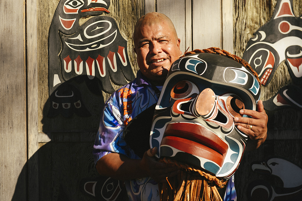
Traditional skills live, credit Canadian Tourism Commission 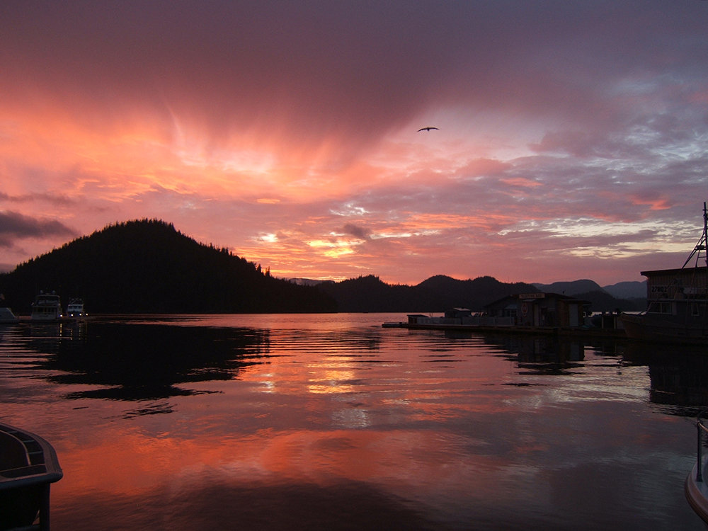
Sunset over the Great Bear Rainforest, credit Sullivan Bay Marina

Remote and unexplored. Visit the most rugged and inaccessible area on the coast of B.C. The many small islands here protect the waters of the Inside Passage and are home to the rare Kermode Bear (Spirit Bear), Grizzly and Black Bears. While you may spot the Spirit Bear at the water’s edge seeking a spawning salmon in one of the many Coho, Pink, Chum and Chinook bearing streams in the area, the anglers draw in the Great Bear Rainforest region is that it is on the direct path of giant Chinook (up to 85lbs. or more!) returning to Rivers Inlet just to the south and schooling and plentiful Coho as they head on to larger rivers to the south. The small islands and passages hold bait and tremendous opportunity to catch salmon while peeking out to the open ocean can produce halibut and bottom fish of all kinds.
Getting There and Provisioning
If you start your trip in southern BC, you need about a week to reach Port Hardy or Port McNeill, the last two full service ports before you venture north on Queen Charlotte Strait to Cape Caution and the southern edge of the Great Bear Rainforest. Use our searchable map to locate sources of fuel in the GBR. You will almost certainly need to refuel and restock at Shearwater Resort or Bella Bella. Bella Coola and Dawson Landing are alternatives, in the central part of GBR region. The remainder of the marinas and communities have limited services. If you explore the northern part of the region, or are cruising on to the Northern Passages region or Alaska, you must refuel at Shearwater Resort. Hartley Bay and Kitimat have fuel and other provisions, but they are off the route north. Use them as bases to explore the northern GBR.
Cape Caution, Outer Islands and Hakai Recreation Area
Rounding Cape Caution takes careful planning and patience waiting for the right conditions. This is the wild west coast. Here you can pick your way between reefs to find a spectacular sandy beach all to yourself. In settled weather, you can explore from island to island. Check the kelp beds for the rare sea otter, which is recolonizing the area.
If you feel like a little civilization along with your sandy beach, pull into Pruth Bay on Calvert Island. Its protected anchorage ends at the Hakai Research Institute’s dock, from which you can walk a well-marked path through the forest to a beach where surf crashes. At the end of the beach is a well-marked hiking trail that leads to a viewpoint or to another beach.
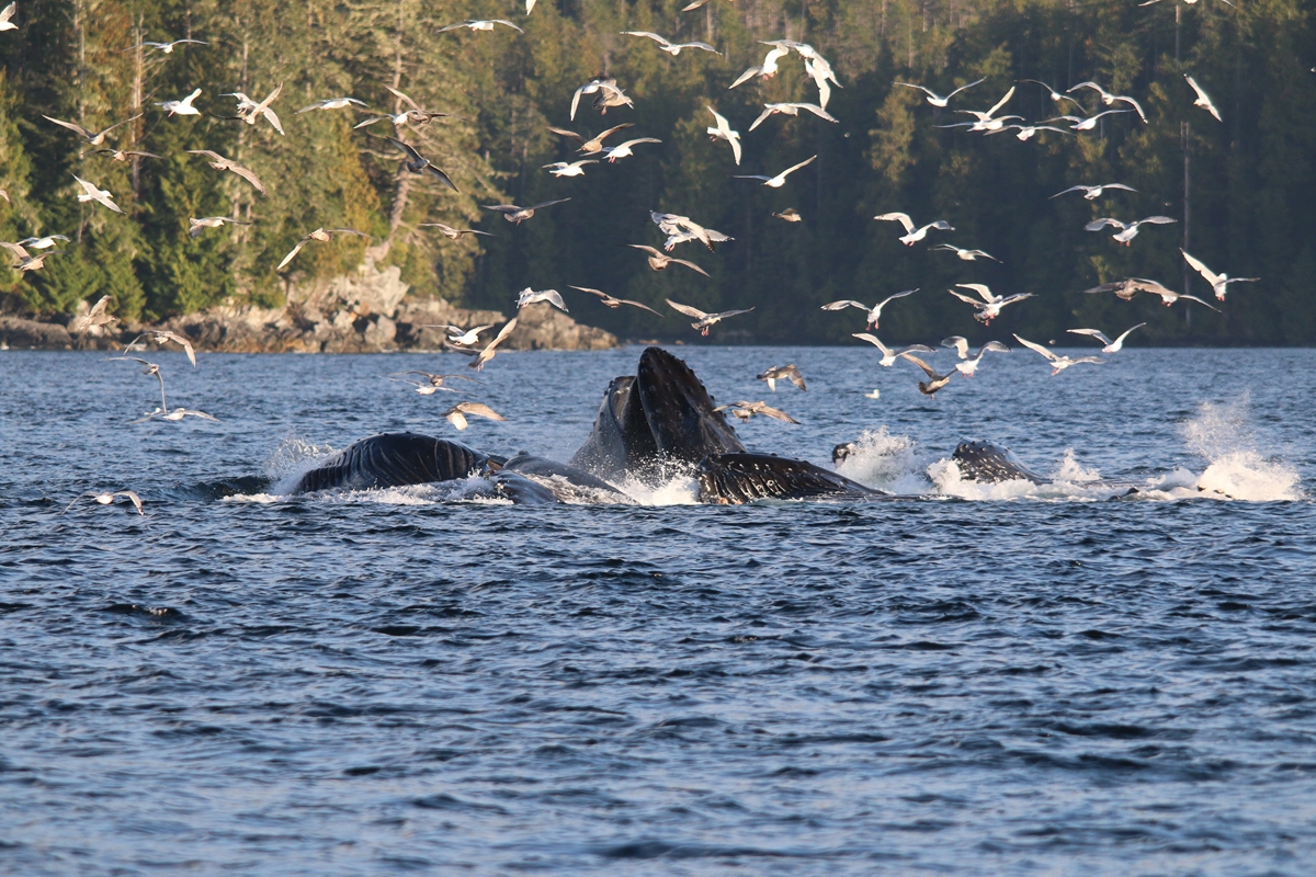
Heading north up Fitzhugh Sound, expect to view at least one humpback whale. On a good day, dozens.

humpback whales bubble netting – credit Pacific Yellowfin 
have it to yourself – credit Pacific Yellowfin
Burke Channel, North Bentnick Arm and Bella Coola
Northeast of Fitzhugh Sound, a long channel cuts east into the mountains. At the end of the channel is the Nuxalk community of Bella Coola. If you are heading north from Cape Caution, this may be the first fjord you explore. Along the way to Bella Coola, you may encounter whales and dolphins, see bears in the estuaries, soak in a natural hot spring on the edge of a meadow, and visit an amazing historical artefact: In 1793, Alexander MacKenzie crossed what was then called Rupertsland and reached the Pacific Ocean here. He left his name carved In a rock above the sea. At Bella Coola there are many services for boaters at the marina, as well as guided wildlife and fishing day-trips from town. Click the link for more information about Bella Coola Valley Tourism
Bella Bella, Fjordland, Klemtu
Bella Bella, a town of 1,000, on Campbell Island, is the regional centre of the Heiltsuk First Nation. There are a few services in town, water and fuel at the government dock, and more services, including moorage, in neighbouring Shearwater (on Denny Island). From here, you can strike out toward the spectacular Fjordland region, where granite mountains rise along each side of narrow channels. Waterfalls are many here but anchorages are few, so plan carefully. Southwest of Fjordland is the Kitasoo-XaiXais village of Klemtu. There are services and water here and this welcoming village has a spectacular big-house, with carved house poles, a painted screen, and fire pit. Inquire at the tourism dock about hiring a local guide for a tour of the big-house. It is well worth it.
Princess Royal Channel, Bishop Bay Hot Springs, Hartley Bay and Whale Channel
This waterway is part of the main inside passage route. Much of the time, its western shore is Princess Royal Island, famous for its spirit bears. The spirit bear is a rare white variety of the black bear. In this region of the Great Bear Rainforest, anywhere from 1 in 50 to 1 in 10 bears may be a creamy white colour. Occasionally one is spotted on the mainland side, but most are seen on the islands, where they have less competition from the larger grizzly bears. Watch the shoreline and creek mouths for bears.
There are several anchorages in inlets along this route with spectacular vistas of snow-capped mountains with forested flanks that fall to creeks, meadows or mudflats and then to the sea. Anchoring here is tricky. Just north of Princess Royal, up Ursula Channel, is a tiny park that demarks a natural hot spring called Bishop Bay. West of Bishop Bay is the welcoming community of Hartley Bay. There are water and services here. For a fee, you can hire a bear guide to take you on a day trip in the region. Most boaters are on their way to Prince Rupert or Alaska. A side trip to Kitimat is worth it, with fabulous MK Bay Marina to welcome you.

Adventure tour in Great Bear Rainforest, credit Boomer Jerritt 
Going ashore in the Great Bear Rainforest, credit Canadian Tourism Commission