

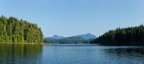
Broughton Archipelago
Peter A. Robson, former editor of Pacific Yachting magazine, described the allures of the Broughton Archipelago best.
“Due to [the Broughton Archipelago’s] distance from the major economic and population centres, it remains little touched by industry or settlement. It is an area of pristine beauty where cruising boats can have an anchorage all to themselves for as long as they like. It is an area so jam-packed with winding waterways and places to explore that one could spend a lifetime simply poking about. It’s also home to some of BC’s more interesting destination marinas peopled by some of the province’s true characters who will provide plenty of down-home hospitality and make your stay unforgettable. There is also a strong First Nations heritage, evidenced by the area’s pictographs, old and new villages and totems.” (Dreamspeaker Cruising Guide to The Broughtons)
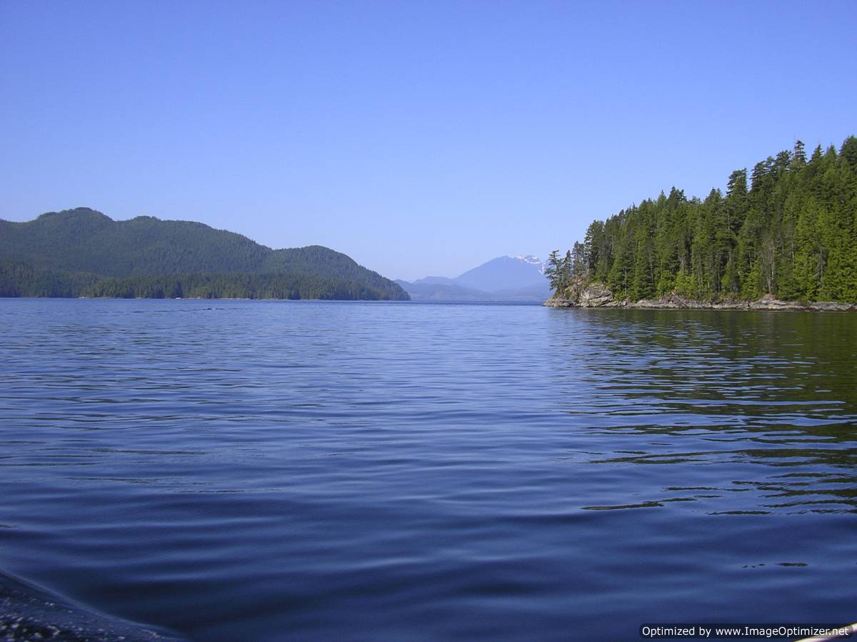
The Broughton Archipelago epitomizes the wild, but civilized, coast of British Columbia. One moment you are watching whales breach without a hint of humanity in sight, and the next you are rounding a point into the shelter and comfort of a resort famous for its character, cuisine and cellar. Carol-Ann Giroday said it well. “The Broughtons are just far enough away to be a challenge, yet close enough to be accessible. Up here, you’re on your own, yet within a half-day’s run of civilization.”
As distances go on BC’s coast, the Broughtons are not that far from major population centres and popular cruising areas. We know they lure boaters, because the Broughton Archipelago-Johnstone Strait is the most viewed coastal sub-region on this website. However, many boaters hesitate to leave the comfortable confines of the Salish Sea. We hear three reasons why boaters don’t venture to the Broughton Archipelago: navigational challenges, isolation and poor weather. Travel north of the Salish Sea is less routine than a trip to the Gulf Islands, but the rewards are worth the additional time and planning required.
Here is what Mark Bunzel says about the navigational challenges.
“For many cruisers, there seems to be a psychological barrier to venturing beyond Desolation Sound. For some it is the angst of passing safely and comfortably through the challenging tidal rapids that lead to the Broughtons (see “BC Tidal Passes Part 2: Passes Beyond Desolation Sound,” for details on transiting these rapids). Or they worry about a passage on sometimes windy and challenging Johnstone Strait. However, with a little advance preparation, timely weather reports and a good tide and current guide, getting here is really not difficult.” (Canadian Yachting)
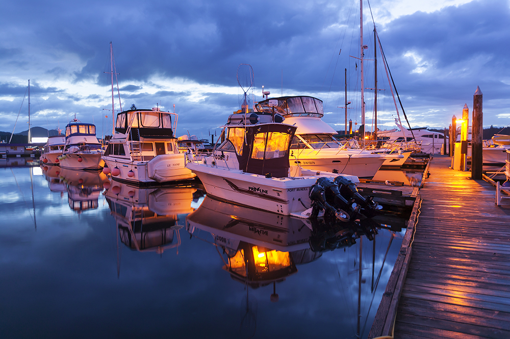
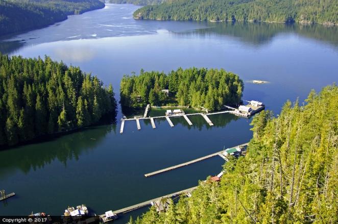
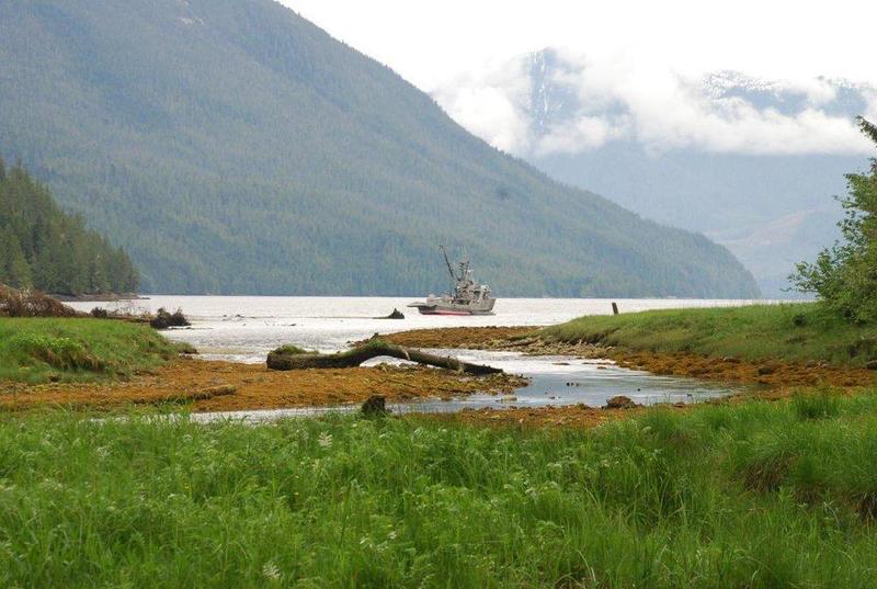
Leaving Campbell River at a well-timed hour, most power boats can be skirting the Broughtons within a day. Telegraph Cove, Port McNeill and Port Hardy are supply bases. There are more than 20 marina resorts in the islands; enough that one can tie up every night, but why do that when you can have heaven on water to yourself. You will not be alone. If you stick to the main passages, you will see plenty of other boats.
Let’s be honest: the water north of the Salish Sea is cooler. One needs to be a bit hardy to enjoy a swim, except in some sheltered places. It takes a week or so longer to warm up in the Spring and it cools down a week or so earlier in the Fall. In between, it’s mild in the Broughtons, with daytime temperatures in the low to middle 20s °C (70s °F).
To help you make up your mind to explore these living waters, here is a sample of best places to set the hook and take it all in. We arrange our anchorages from west to east, south to north. Our guide is not a substitute for large-scale charts and guidebooks and their use is absolutely necessary. Chart numbers refer to Canadian Hydrographic Service series. Coordinates are shown for anchorages with confined locations.
You will enter the traditional territory of several First Nations as you traverse the Broughton Archipelago. There are many archaeological and sacred sites on the islands. We recommend that you read our Travel in First Nations Traditional Territories guide so you can be confident that you are respecting the Indigenous Culture.
Tallac Bay — Chart 3312 | 50° 26.57 N 125 28.46 W
This little haven off Cordero Channel is protected from all winds except southerlies. The approach is obvious, but stay close to the western shore as you enter. Good holding in sand and mud bottom in 3-5 metres. Room for two vessels. A creek entering in the NE corner flows through a small estuary which attracts seabirds and sea otters. There are reports that the fishing is good near the mouth. An alternative, nearby anchorage is to the W around the blunt point and behind a set of islets (50 26.40 N 125 20.60 W)
Clio Channel, West Cracroft Island — Chart 3545
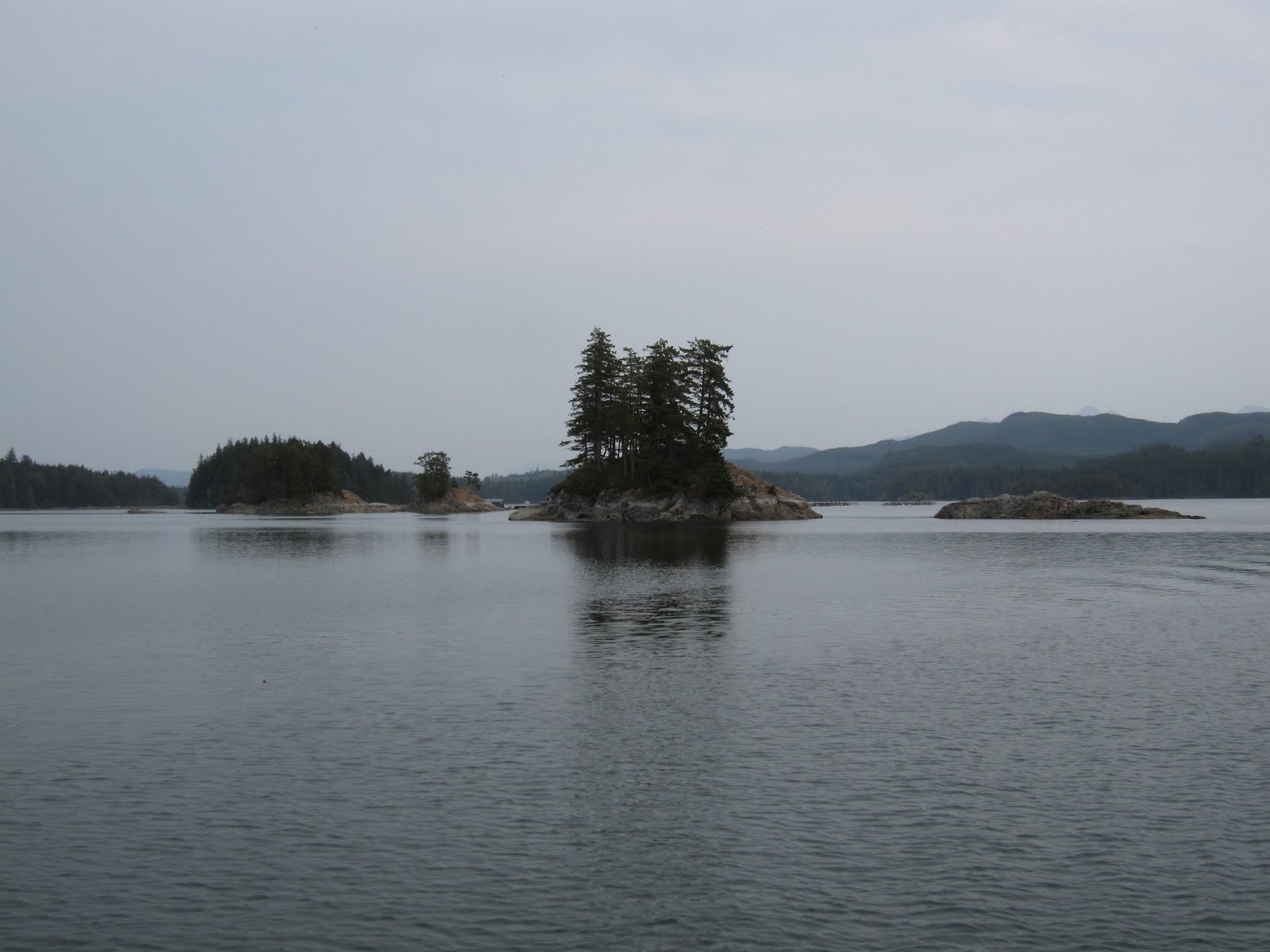
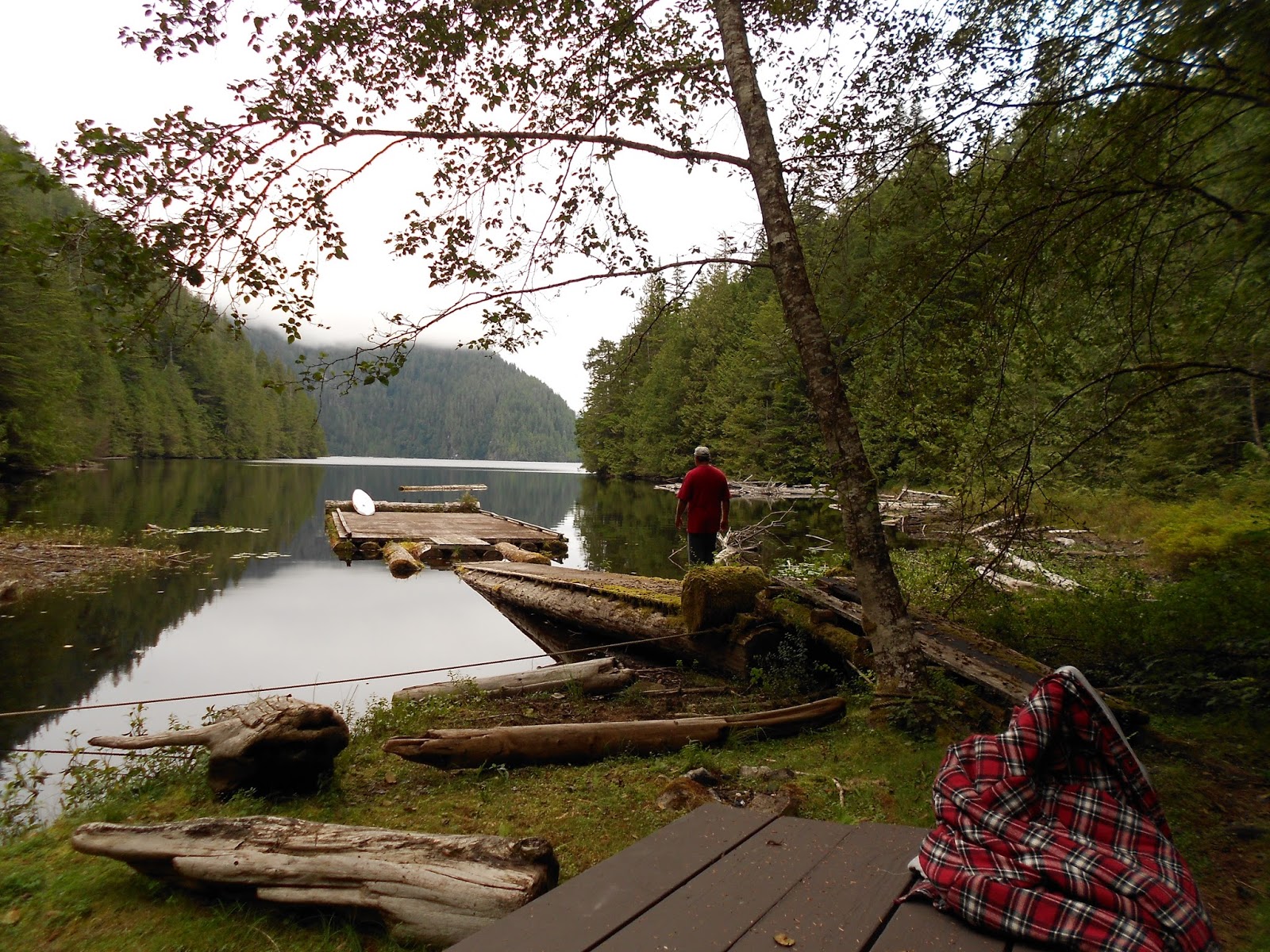
We like everything about this labyrinth of islets and channels within easy striking distance from Telegraph Cove. On the way up Clio Channel, Klaoitisis Island, an assortment of islets, and crimps in West Cracroft Island create several secure anchorages and excellent paddling grounds. Two basins at the W end are secure in most weather. The southern basin (Potts Lagoon) has the remnants of an outpost created by the eponymous settler in 1908, and some surviving float homes. Much of the shore is clothed in meadows and marshes, giving an array of softer hues against the dark green forest. Kayaking through the many islets, you are sure to see many species of birds, likely sea otters and sea lions, and possibly a foraging bear.
Cormorant Channel Marine Park — Chart 3546
Cormorant Channel Marine Provincial Park is made up of a number of islands off the Pearse and Plumper groups of islands, situated at the western end of Johnstone Strait, between Hanson Island and Cormorant Island (Alert Bay). This is the core habitat of the northern resident Orca population, one of the best places on earth to see them. Humpback and Minke whales, Harbour porpoises, Dall’s porpoises and Pacific white-sided dolphins also ply these waters. Look for seals and sea lions sunning themselves on the rocks. Alert Bay, with world-famous U’mista Aboriginal Cultural Centre and Malcolm Island, home to the former Finnish socialist community of Sointula, are within easy reach. This part of the Johnstone Strait is known for strong currents. Approach the Pearse group from the SE into the centre of the group and anchor on either side of the smallish, flat island (50 34.51 N 126 51.14 W). The best place to spend the night in the Plumber group is in the cove between the most northern two islands, separated by a very narrow channel (50 35.24 N 126 48.87 W).
Crease Island, Goat Islands — Chart 3546 | 50 36.78 N 126 38.17 W
This is a pleasant first stop after leaving Vancouver Island ports to explore Knight Inlet. It offers good protection from all quarters, except E. Best to anchor as close to the W shore as your draft will allow. Good holding in mud in depths of 3-8 metres. A small stream enters from due W and beachcombing is splendid at low water. Several islets and a reef near S shore make for enjoyable paddling or dinghy touring. Some of the islets are a good place to stretch you legs, if you don’t mind scrambling over rock shelves. Eagles seem to love this place. You will, too.
Echo Bay Provincial Marine Park — Chart 3515 | 50 46.78 126 29.00
The Park, with wharf for vessels under 7 metres, trailhead to Proctor Bay and fine shell beach is at the head of the bay. This site has been used by First Nations people for hundreds of years, as evidenced by the many middens found within the Park. There is a Great Blue Heron rookery in the SW corner and visitors will see a colony of these birds throughout much of the summer. There is a pit privy at the park site. But these are only a few of the reasons this spot is on our list. Echo Bay is home to Pierre’s Echo Bay Lodge, fabled for its character (and Pierre’s), social gatherings and the Wednesday night pig roast. From the Park or via water you will want to visit Billy Proctor’s museum in the bay named after him. Visit also the Salmon Coast Field Station and the gallery of artist Yvonne Maximchuk. You will stay in this place for at least a couple of days, we wager. You can moor at Pierre’s or find a spot to anchor deep in Echo Bay.

Knight Inlet — Chart 3515 | 50 41.42 N 125 44.10 W
Knight Inlet penetrates deeply in the mainland, which tempts one to reach its head and feel the power of vertical walls and glaciered mountains. Unfortunately, these walls funnel strong winds, usually outflows on summer days. The topography is not good for finding a place to anchor, although the head does have a couple of places with the right depth and good holding, but stern-tying is impractical. The prudent recommendation is to use Glendale Cove as your base and take a day trip further up the Inlet. The Cove is 20 nautical miles from the junction with Clio Channel. If you get lucky with the wind and current, maybe make it to the head and spend the night. You will not have privacy in Glendale Cove. Knight Inlet Lodge is located on the W shore. And, according to the folks at the Lodge, this is home to one of the highest concentrations of Grizzly bears anywhere. There is room for several vessels along the E side and near the estuary. If your course lies up Tribune Inlet, then Sargeaunt Passage is spectacular option from the main channel. There is secure anchorage at the narrows near the middle of the Passage.
Simoon Sound — Chart 3515 | 50 51.44 N 126 30.64 W
Located near the junction of Tribune Channel and Kingcome Inlet, the Sound is deep, even around the small islets at the centre and E side of anchorage in twin bays on the N side of the Sound. Untroubled except in strongest winds. There are numerous good spots to anchor with the best protected on the far W side and the far east side. Dzawada’enuxw First Nation reserve is on the N shore to the W of one of the creeks. The views here a spectacular, with sheer Bald Mountain dominating the eastern skyline. Two creeks enter the Sound. Near their mouths and in a couple of nooks there is room for stretching your legs at low tide.

Moore Bay — Chart 3515 | 50 52.84 N 126 33.36 W
Located on the E side of the entrance to Kingcome Inlet, about two NM from the eastern tip of Broughton Island. Shawl Bay Marina is due south. There are a handful of islets in the Bay and groups of drying rocks in the centre of the entrance and at both sides close to shore. The Bay is deep and so anchor close to shore in the NE corner. There is a Forestry Service dock on the E shore and three buoys nearby. Exposed to nor’westerlies. Safe anchorages are few in Kingcome Inlet. Moore Bay is a convenient staging area and there is good food and good company within earshot on a calm day.
Kwatsi Bay — Chart 3515 | 50 51.69 N 126 14.98 W
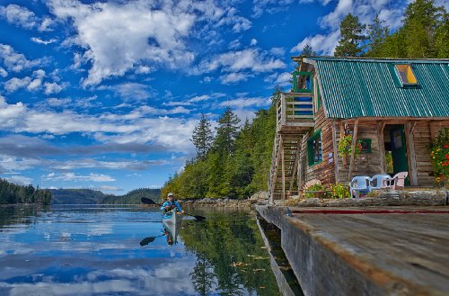
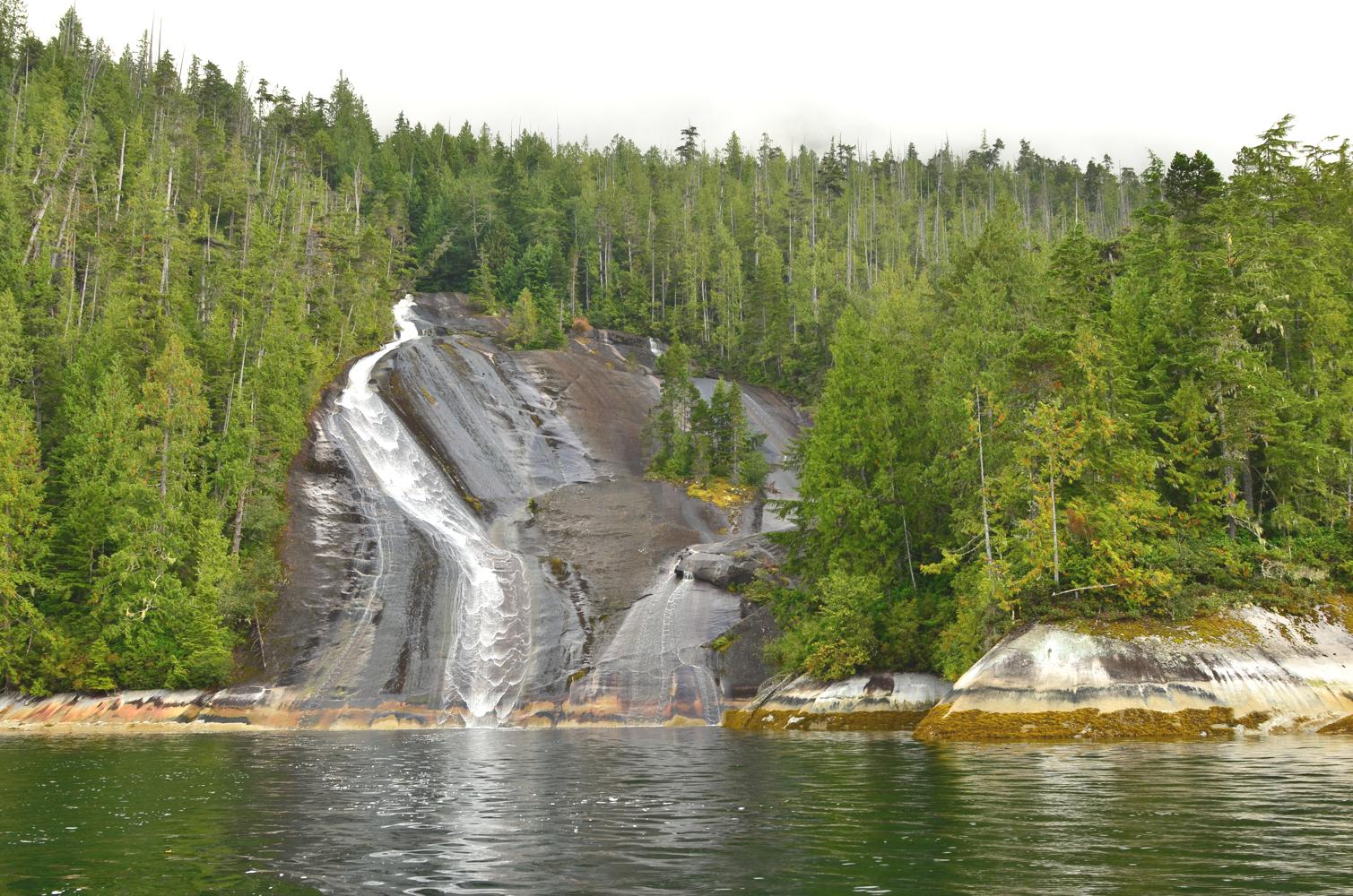
Located at the head of a sound off Tribune Channel, this is one of the most stunning places in the area. Rock walls form a bowl around the Bay with feathery waterfalls plunging directly into the sea. Nearby Lacey Falls on Tribune Channel is one the Broughtons’ most iconic wonders. Water is deep enough for you to get a close-up view or photograph of the Falls. The approach to the Kwatsi Bay is unobstructed. Best spots to anchor are behind the rocks on the W side of the entrance, or in the eastern bay. You will not have this place to yourself. Hospitable Kwatsi Bay Marina offers a place to stretch, shower, catch up on email and socialize.
Bond Sound — Chart 3515 | 50 51.64 N 126 14.98 W
Located at the big bend in Tribune Channel, this spot is for those who want almost guaranteed solitude. Chances are you will have the entire Sound to yourself. A Reserve of the Kwikwasut’inuxw Haxwa’mis First Nation is adjacent to the E side of the Atha River. Protection from the SW is not good, otherwise fairly secure with stern-tie possibilities on the N side of the Ahta River estuary. The Ahta River basin has not been logged. You can explore the river for almost a kilometre. The rock-strewn shell beaches are a main attraction. Pacific white-sided dolphins are a common sight, along with bears foraging near the river mouth.
Turnbull Cove — Chart 3547 | 50 57.26 N 126 93.10 W
Tucked up the furthest reaches of the Broughton Archipelago and reached via Wells Passage, this is one of the most sheltered and picturesque spots in our list. The basin is large enough for several boats and is sheltered in all weather, although susceptible to westerly inflows. Stay to the centre of the narrow entrance channel and stern tie on the E shore or anchor off of W shore in 6-9 metres with good holding in firm mud. At the far northern end of Turnbull Cove you can hike to Huaskin Lake — look for the collection of pilings and the BC Provincial Parks trail head sign. There is a rusting steam donkey at the head of the trail, along with other evidence of logging. The 1-kilometre trail is a bit steep and there is a staircase carved out of a log down to a weathered dock and picnic table. The viewscape is dominated by a helmet-shaped buttress. Turnbull Cove is a staging area for side-trips through Roaringhole Rapids to Nepah Lagoon or the scenic journey to Watson Island.
Blunden Harbour — Chart 3548 | 50°54.372’N, 127°17.558’W
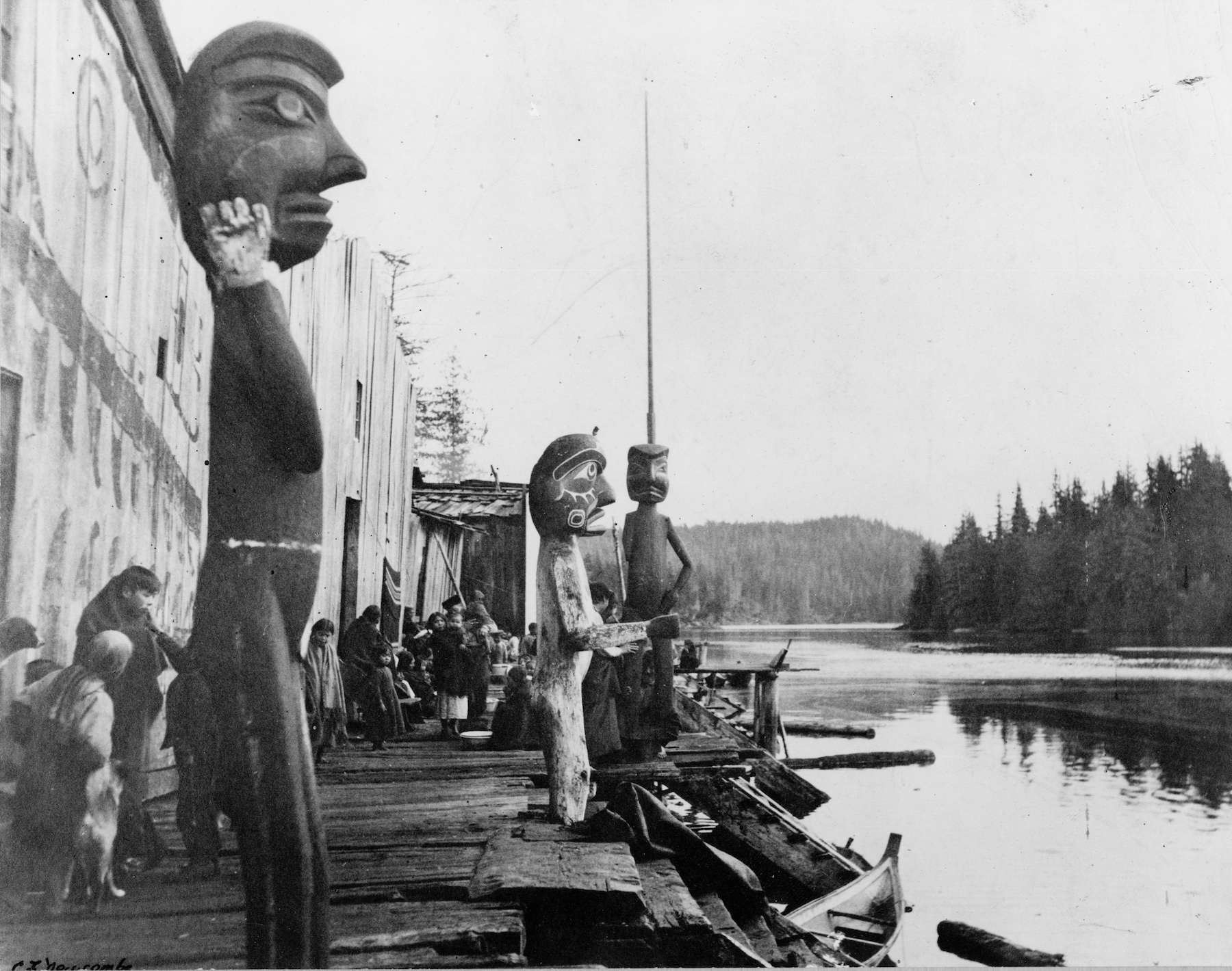
Blunden Harbour is on the outer rim of the Broughtons, within easy range from Port Hardy. It is haven on an otherwise long stretch of exposed coastline. The best anchorage is nestled within a mini-archipelago with tremendous variety of shoreline, including mudflats, several streams, shell beaches, and many-coloured rocks. The basin, located behind Robinson Island, is large enough for several boats and is protected in all weather. The entrance to the harbour is narrow between rocks. Caution is advised. At the beginning of the 20th century, this was home to the ‘Nak’waxda’xw people, famously painted by Emily Carr. You may wish to stay for a couple of nights, to explore the many nooks and to enjoy excellent fishing and crabbing. Watch the tides or you will get stranded by current or mud.

Drury Inlet — Chart 3547
A trip to Blunden Harbour should include a visit to Drury Inlet. The entrance at Stuart Narrows is narrow and currents reach 7 knots. Use a guidebook and charts for best route and timing. Oriented east-west, the Inlet can be a funnel for westerlies. There are five anchorages, all offering good protection in most weather. The first, Richmond Bay, is just inside the Narrows and is secure except in strong westerlies. Jennis Bay Marina can provide you with a place to tie-up, showers, Wi-Fi and a chance to swap stories and a cabin: take your pick between floating and on-land. Good anchorage can be found in the well-protected NW head of the Bay. The W end of the Inlet has three secure anchorages. The Muirhead Islands (50 55.15 N 127 8.56 W) are another of those mini-archipelagos with lots to explore and good shellfishing. Sutherland Bay is at the W end, well-sheltered with room for several boats. The best choice for large craft. Actress Passage leads north to Bond Basin. There are several places to stern tie in both. However, navigation is tricky and currents are strong. Many stage from Sutherland Bay and explore Actress Passage and beyond by dinghy or zodiac. The Inlet is as peaceful as any place on Earth. The landscape is inspiring, with Mount Bullock a focal point.