

This guide to anchorages should be used in tandem with our searchable map of the Great Bear Rainforest. Our guide is not a substitute for large-scale charts and guidebooks and their use is absolutely necessary. Chart numbers refer to Canadian Hydrographic Service series. Coordinates are shown for anchorages with confined locations.
You will enter the traditional territories of many First Nations as you traverse this vast region. There are many archaeological and sacred sites on the mainland and islands. We recommend that you read our Travel in First Nations Traditional Territories guide so you can be confident that you are respecting the Indigenous Culture. Inquire, ask questions about locations you are asked not to visit.
We begin at the south. Cape Caution marks the beginning of the Great Bear Rainforest region. Rounding it is the most challenging leg of a GBR tour. Consult guidebooks about the right conditions for making the passage.
Smith Sound — Chart 3931, 3934, 3605
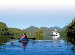
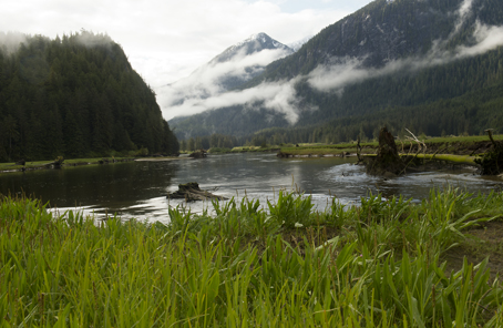
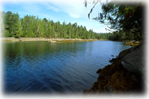
This is your first refuge north of Cape Caution and well worth visiting. There are three passages into the Sound, the clearest is between Egg Island to the south and Table Island to the north. There are half-a-dozen locations offering protection, convenient depths and scenic splendour. Millbrook Cove is near the entrance on the N side. It has room for several boats. Best anchorage is behind the island at the N end of the Cove. Takush Harbour is near the entrance of the southern passage. Caution is required when entering between two islets. Within, best locations are between Ship Rock and Abrupt Point and in Fly Basin on the south arm. The passage from Broad Reach to Ahclakerho Basin is best run at high tide, favouring the east shore. Anchor in three to four metres with excellent holding in the basin. The Ahclakerho Islands (pictured) and the Channel are ruggedly stunning and a kayaker’s delight. The inner reaches, Smith Inlet, offer only fair-weather anchorages.
Rivers Inlet — Chart 3932
Rivers Inlet offers a partial return to civilization. It hosts Duncanby Lodge, Dawson’s Landing, Rivers Inlet Fishing Lodge and the Wuikinuxv Nation community of Rivers Inlet. There is good reason why there are fishing lodges here. You are welcome to tie up at Duncanby and Dawson’s Landing General Store. Both have fuel and the latter has grocery and liquor sales. The Inlet is enjoyable to explore and Dawson’s Landing offers a base. Near the opening of the Inlet on its eastern side, is Draney Inlet. The narrows at the entrance can race at 10 knots, but with care are navigable at slack tides. Inside you have the long inlet to yourself. Anchor off the 30-metre falls tumbling out of Caroline Lake. There is a trail to the lake. Another excellent anchorage lies at the extreme tip of Inlet, near the mouth of Lockhart Gordon Creek, which is dinghy accessible. At the mouth of Rivers Inlet is Penrose Island Marine Park. Sinuous, island-surrounded Penrose Island has anchorages on all sides, making it certain there is refuge in all but the worst of conditions. No facilities at the park, but ample beach hiking and island kayak/dinghy hopping make for a memorable visit.

Kwakume Inlet — Chart 3935 | 51 42.32 N 127 53.13 W
This little inlet is between Rivers Inlet and Namu. There is a drying rock about 200 m west of the entrance. There is sufficient depth on either side, but keeping the rock to starboard is preferred by most skippers. The entrance is tight, but depth inside is suitable (7-10 m) and bottom holding is sound. This anchorage is secure in all weather. The inlet offers memorable mountain and sea vistas and room for several boats. Mount Buxton on Calvert Island commands the western view. There is an islet near the head of the inlet with a drying rock nearby. A good place to view seals. The lagoon at the head of the inlet is worth exploring by dinghy. It’s entrance or the beach on the north side near the entrance are good for stretching legs and picnicking. Although not recommended as an anchorage, nearby Koeye River (51 46.46 N 127 52.92 W) offers temporary shelter and the river may be explored by dinghy as far as Koeye Lake at high tide. A camp operated by the Heiltsuk First Nation that supports youth education in culture and the environment is located on the southern shore.

Pruth Bay — Chart 3935 | 51 39.30 N 128 07.44 W
This anchorage is within the Hakai Luxvbalis Conservancy Area The conservancy straddles Hecate and Calvert Islands, south of Hakai Pass, on the west side of Fitz Hugh Sound, due west of Kwakume Inlet. The Conservancy is managed under an agreement between the Heiltsuk Nation and the Province of British Columbia to co-operatively attain conservation and recreation objectives for the area. The Hakai Beach Institute has a pier and research facility in Pruth Bay. The present trail from the anchorage at Pruth Bay to West Beach, located on Calvert Island, crosses land owned by the Institute. From the trailhead at the foot of the pier, a trail runs north along the shoreline, and then west around the north side of the Institute buildings to West Beach. Pruth Bay lies at the head of east-west Kwakshua Channel, secure in winds from any direction, except the rare nor’easter. There is ample room for several boats with depths of 3-8 m and good holding in sand and gravel. Pruth Bay and surroundings are known for excellent fishing, kayaking, scuba diving and beach combing. Hakai Lodge is nearby on the western side of Hecate Island.
Lewall Inlet — Chart 3935 | 51 45.975 N 128 04.723 W
Lewall Inlet cuts through the middle of Stirling Island almost dividing it in half. The L-shaped Inlet is extremely narrow with rocks and shoals lying just beneath the water’s surface. There is a shallow spot to starboard near the 90-degree turn in the channel. Once in, you are as secure from weather as can be with firm holding. And, if you have not had enough solitude, this is the antidote.
Burke Channel — Chart 3938, 3939, 3940, 3974
Bella Coola, a provisioning and R&R destination lies at the top of the 48-NM Burke Channel. Along the way are a few choice anchorages. Kwatna Inlet (52 05 N, 127 30 W) lies to the south of the Channel about half way up. It is outstandingly scenic and there is firm anchorage near the Inlet’s head in about 20 m of water. There are shoals near the head but plenty of room to anchor outside of the shoals. Otherwise, there are no significant hazards. The Kwatna River flows into Kwatna Bay, located on the east side of the Inlet, creating an estuary with meandering channels and a large tidal flat that is a BC Parks conservancy. The conservancy serves as a feeding area for grizzly bears and as important habitat for juvenile salmon. South Bentinck Arm is 17-NM of mountain-framed glory, departing SE from Burke Channel not far from Bella Coola. Big Snow Mtn. and Fougner Mtn are white-capped year-round. Anchorages are in Larso Bay (52 10.324 N, 126 51.171) in 20 m or at the head of the Arm, SW corner, in 22 m. Bonus: about 5 NM from the entrance on the W shore just past little Bensin’s Island are the Tallheo Hotsprings.

Codville Lagoon Marine Provincial Park — Chart 3939 | 52 03.332 N 127 52.726 W
The lagoon and park are on the W side of King Island off Fisher Channel. Entrance is via a narrow passage with obstructions, notably a submerged (2 m at LW) rock just north of mid-channel, but they are easily avoided. There is secure, all-weather anchorage behind the central island in 10-12 m. It is a popular spot, so if you are seeking some social action after many a solitary night, make this a stop. Seals commonly bask on the southern tip of the island. This is a significant place for the Heiltsuk People and should be respected as a heritage site. The red sand beach along Sagar Lake and a fresh warm-water swim are incentives to take the 15-20 minute hike from the signed trailhead at the eastern-most extent of the lagoon. There is little space to land, so a kayak is the best way to access the trail.
Beales Bay and Gunboat Passage Lagoon — Chart 3939 | 52 10.582 N 127 58.699 W
It is almost certain you will replace stores, fuel up and enjoy the cheer at Shearwater Resort. A nearby quiet refuge is, Beales Bay on the north side of Gunboat Passage, a few NM east of Manson Point. It provides protected anchorage in most weather with good holding a 7-10 metres. The Lagoon is the inner sanctum. The passage is narrow but passable except at low water. The serenity amid active wildlife and towering forest inside the Lagoon makes this place magical. Pilings at the head of the Lagoon are evidence of some former activity here.
Shearwater and Bella Bella
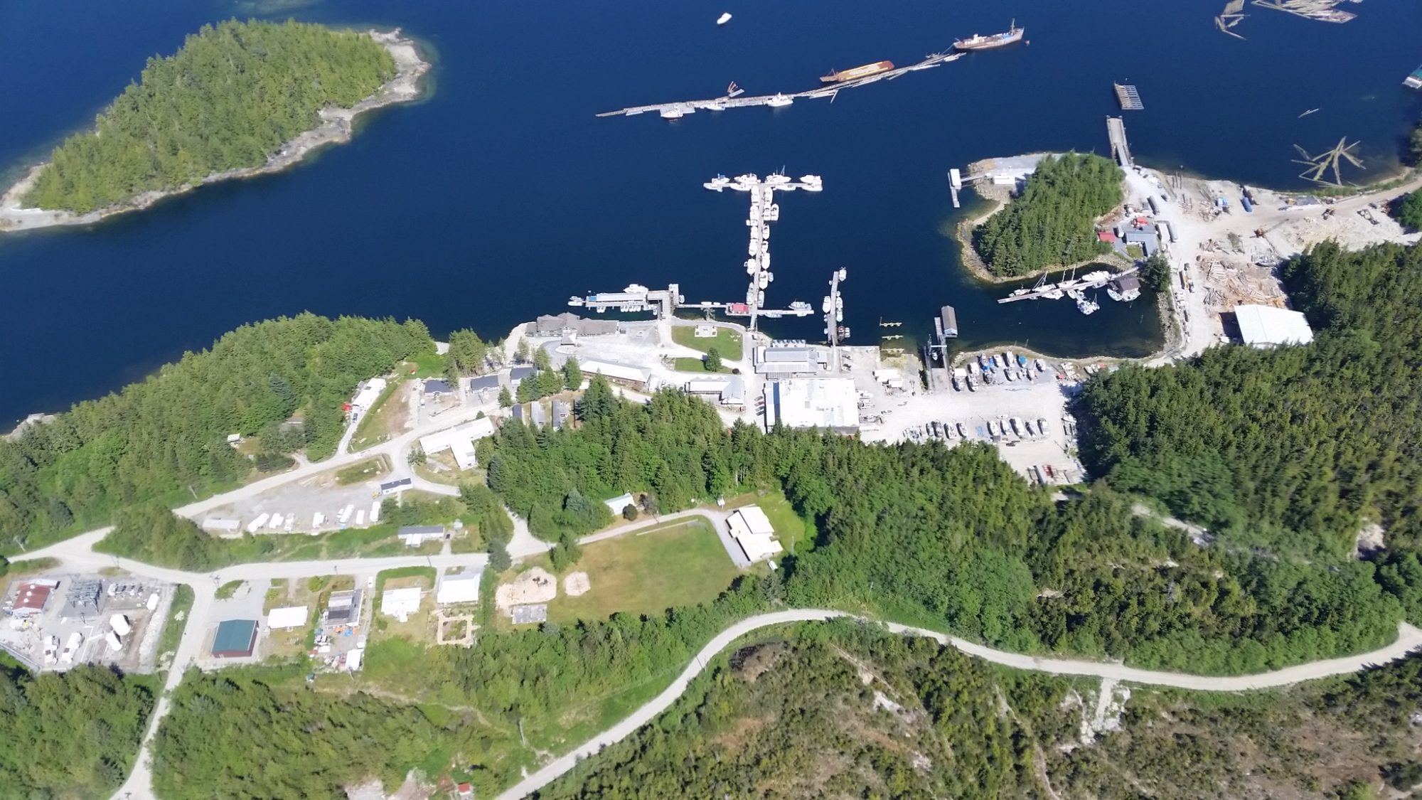
It is almost certain you will stop in at one of these places. They are convenient stops on any route and if you are heading north, they are the last sources of fuel until Klemtu, which is worth visiting, but off the beaten path. Otherwise, next fuel north is Hartley Bay (120 NM). Shearwater Resort epitomises our slogan, “explore the wild, yet civilized, coast of British Columbia”. In the middle of the Great Bear wilderness expanse you find the BC brand of casual, high-quality hospitality. In addition to taking care of your every comfort need, their shipyard can take care of any vessel needs. Bella Bella has fuel, moorage, groceries, ferry terminal, hospital and post office. This almost exclusively First Nations community is a major hub on the Central Coast and worth a visit.
Dean Channel — Chart 3738, 3739, 3740, 3781, 3789, 3939, 3974
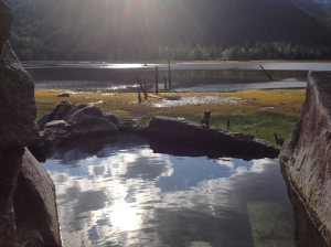
Dean Channel is the common return route from a trip up Burke Channel to Bella Coola. Alternatively, if you have elected to pass by Burke Channel, a run up Dean Channel at least as far as Ocean Falls and the Sir Alexander MacKenzie cairn is common. The channel is about 46 NM in length with powerful scenery and, unlike many fjords, there are several good places to spend a night at anchor. Eucott Bay (52 27.212 N 127 18.455 W) is near the junction of North Bentinck Arm and Dean Channel, a short haul from Bella Coola. Several ribbon-like waterfalls cascade from hidden heights. There is an accessible hot spring, well marked by pilings and easily visible. The bay is shallow with firm anchoring for several boats in 4-5 m. Cascade Inlet (52 25.06 N, 127 25.13 W) is well-named; deep, steep-walled, with several spectacular waterfalls (in season). You may prefer just to explore, but if you wish to spend a night, best location is on the NE side near the head in 20 m. Elcho Harbour (52 22.34 N,127 29.12 W) is the place where Sir Alexander MacKenzie commemorated his arrival on the Pacific shore in 1793. A rock inscription is about 13 m up on a bank near the entrance to the Harbour above a shallow, gravel nook. There is protected, firm anchorage in about 22 m in the NE corner.

Ocean Falls — Chart 3939 | 52 21.172 N 127 41.805 W
Ocean Falls is a never-say-die community at the head of Cousins Inlet, north side of Dean Channel near its mouth. In addition to providing most services, it is worth visiting to learn a piece of BC’s coastal history. At one time, 3500 people lived here, supported by a pulp mill. Now, its buildings have been re-purposed and mariners are welcomed. The residents have been thoughtful enough to provide a free wi-fi hotspot at the dock. Fishing charters, site seeing and hikes provide good cause to refresh afterwards with new friends at the pub.
Oliver Cove Marine Provincial Park — Chart 3938 | 52 18.788 N 128 21.264 W
This popular stop-over on Roderick Island is on the main N-S route, off Reid Passage about 1 NM north of the Carne Rock light. Watch for a submerged rocky shelf in the middle of the S entrance and for a drying ledge on the north side of the entrance. Tuck into the eastern sub-cove or the narrow bay on the west side for best protection. The park is known for a rich diversity of inter-tidal sea life. Remember only to take pictures and take care not to disturb the habitat.
Klemtu | 52 35.25 N 128 31.25 W
Klemtu is home to the Kitasoo Xaxais First Nation. The community operates Spirit Bear Lodge, which houses up to 12 guests. The Lodge provides a rare opportunity to experience and learn about the cultural of the inhabitants of this land for 10,000 years. There is moorage, fuel, a range of provisions, showers and laundry, bank machine and post office. We recommend you make this a stop on your Great Bear Rainforest journey. Please follow the Spirit Bear Lodge link to learn more about the region, its people and how to respect land and tradition.

Jackson Narrows Marine Provincial Park — Chart 3941, 3943 | 52 30.88 N 128 17.34 W
The Park is on the E side of Mathieson Channel and is a pleasant stop on the way to Fjordland Conservancy. We recommend extreme caution if you choose to navigate the 20 m-wide Narrows; best done at high slack tide. The best anchorage is S of the Narrows in Rescue Bay Conservancy. The entrance has hazards on the E side. Within it is 15 m deep with fair holding and it is protected against most weather. This is a rarely used anchorage despite having a dramatic, forested shore and extensive tidal areas.
Fjordland Conservancy — Chart 3941, 3942, 3943, 3902
Fjordland is not far off the main route and getting there and back is along a highly scenic circle route up Mathieson Channel and out Sheep Passage. Sheer granite cliffs line the way, punctuated by waterfalls, and backed by lofty peaks. Several estuaries add to the allure of one BC’s most memorable boating destinations. James Bay, on the W side of Mathieson Channel, accommodates big boats. Best anchorages in the Conservancy are at the heads of Kynoch and Mussel Inlets, at Culpepper Lagoon and Poison Cove respectively. Traverse Kynoch Inlet at slack tides to avoid tidal rapids. Anchor near the head of the lagoon, close to a stream mouth. David Bay, on the E side of Mussel Inlet is a more secure anchorage than Poison Bay during westerlies. There are few opportunities for land access and caution is advised due to abundant bear populations. The fishing in both inlets is rewarding.