
This guide to anchorages should be used in tandem with the map of Vancouver Island West.
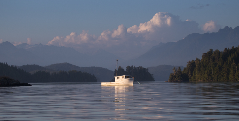
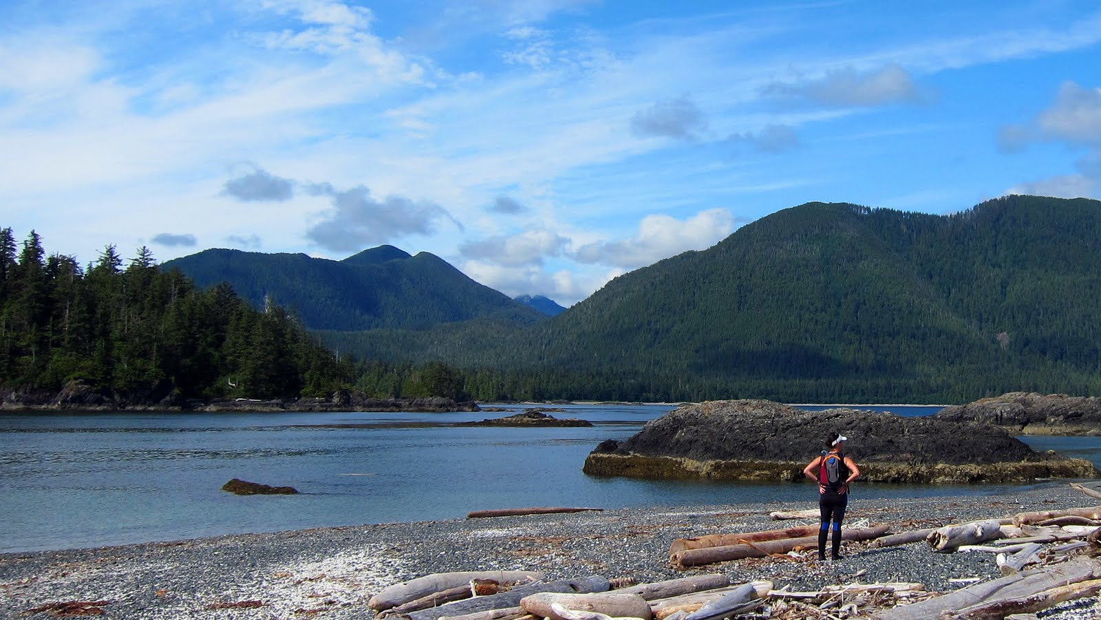
You really are “out there” when you cruise the west coast of Vancouver Island. Almost the entire coast is uninhabited wilderness. The length and size of the swells confirm what the uninterrupted horizon tells you. This is the mighty Pacific; nothing between you and Asia except water. It’s big out here. Big sky, big surf, endless waterways leading into big mountains, big fish.
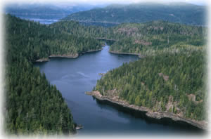
Circumnavigation of Vancouver Island is on a lot of bucket lists. Most commonly, the route is counter-clockwise, with travel on the west side from north to south. The geography of the west coast of Vancouver Island makes it an ideal cruising area. Yes, the ocean can be impassable at times, but most of the actual cruising is done in relatively well-protected sounds along the way. Exposure to the full brunt of the Pacific Ocean is limited to manageable 20 to 40 nautical mile chunks, except around Cape Scott (60 NM).
Our guide to anchorages will begin in the south, because the navigational and safety challenges are least in the south and most craft embark from southern ports. Our guide is not a substitute for large-scale charts and guidebooks and their use is absolutely necessary. Chart numbers refer to Canadian Hydrographic Service series. Coordinates are shown for anchorages with confined locations.
You will enter the traditional territory of many First Nations as you traverse the west coast of Vancouver Island. There are many archaeological and sacred sites on the big island and coastal islands. We recommend that you read our Travel in First Nations Traditional Territories guide so you can be confident that you are respecting the Indigenous Culture.
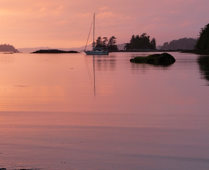
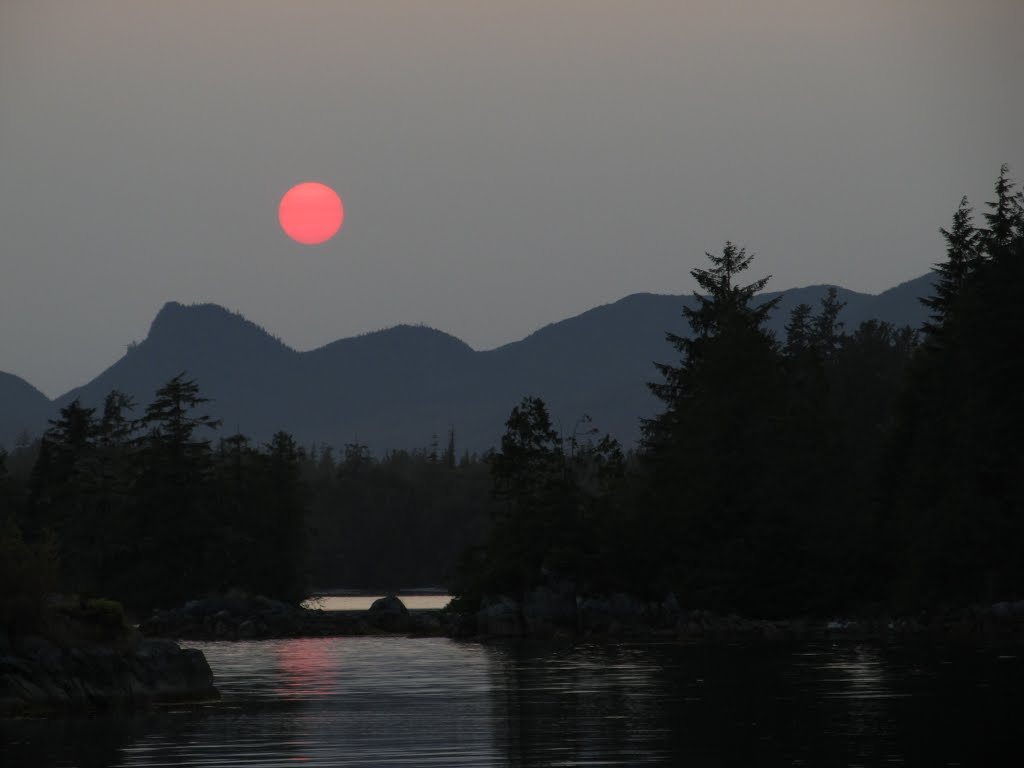
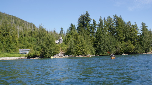
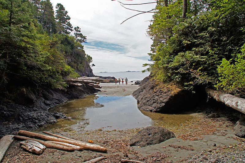
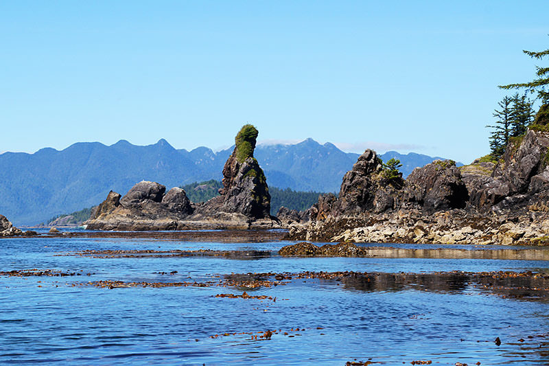
Click on photos to enlarge.
Sooke Basin — Chart 3411
Sooke marks the start of Vancouver Island West. Most services are available and Sooke Harbour and Sooke Basin are protected locations for waiting for favourable conditions to run the Strait of Juan de Fuca to Port Renfrew. The entrance is tricky, so be sure to use a chart and consult a guidebook. The protected waters are surrounded by forests and there are several beaches and parks. This is a perfect place to hang out for a couple of days while you wait for the winds in the Juan de Fuca Strait. Enjoy the many amenities before you head for Barclay Inlet and points north.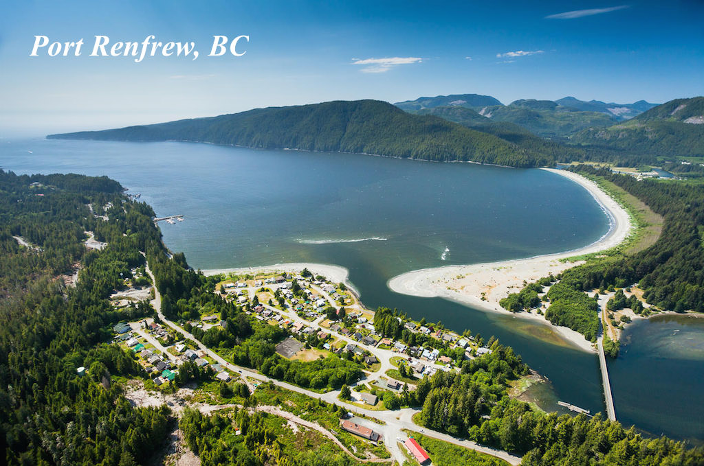
Port Renfrew — Chart 3647
There is no protected place to anchor along the 35-nautical mile voyage from Sooke to Port Renfrew, except the mouth of the Jordan River, but the highway bridge prevents larger or masted boats from finding refuge. The long, narrow bay at Port Renfrew (Port San Juan) offers protection from all wind directions. There is a Harbour Authority at Port Renfrew and rightly-named Pacific Gateway Marina, one of the Mill Bay Marine Group properties. Most supplies and services are available. As anchorages go, it has it charms, but the best lies ahead. The fishing is first class and we are not going to say that again; it just gets better as you go.
The next run for anchorage is 40 nautical miles to the mouth of Barclay Sound. Now you are getting into waters for which Vancouver Island is legend. Scenic, safe anchorages are everywhere. We highlight a few of the best.
Barkley Sound and Broken Group of Islands
The Village of Ucluelet offers the next haven and re-supply opportunity. The channel is well marked. There is a public wharf and anchorage in Ucluelet Inlet.
Bamfield is located near the mouth of Barkley Sound. You can get most supplies at the Village and gas is sold at Poett Nook Marina, a little further up the Sound.
Effingham Island Bay — Chart 3670 | 48 52.63N 125 19.07W
This is one of the largest islands in the Broken Island group, located in the mouth of Barkley Sound. Approach is from the E via Coaster Channel or from S between Gilbert Island and a reef with minimum depth of 3 m. The bay is considered by some to be the best big boat anchorage in the Broken Island group. The small bay in the south-east corner of the bay is best protected and most skippers prefer to stern tie. Secure except during strong westerlies. Effington is an interesting island to explore, with beaches, remains of an Aboriginal village and a sea cave on the island’s east side.
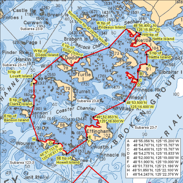
Turtle Island — Chart 3670 | 48 54N 125 19W
The anchorage on the north side of the island is one of the most popular in Barkley Sound. Approach from the E. There are shoals everywhere in the Broken Islands group, so prepare well and proceed cautiously. Secure in most weather conditions. The bottom is variable, so be sure your anchor is holding. The numerous exposed shoals, rugged shoreline and pockets of white sand, along with the panorama of smaller islands against a mountain backdrop, spells gorgeous

Turret, Trickett and Lovett Islands — Chart 3670
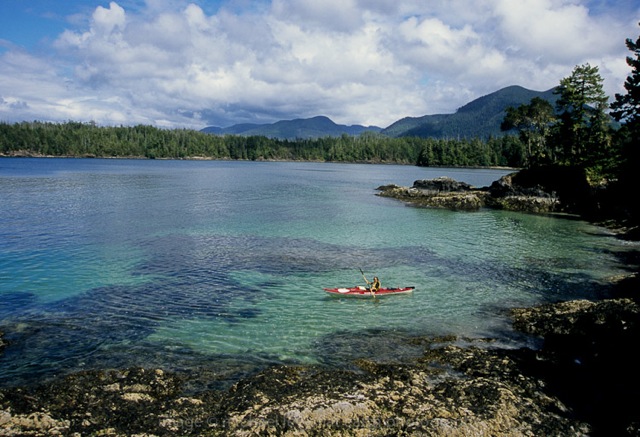
Another of the incredibly scenic, rugged anchorages in the Broken Islands group, located in a round bay near the SW tip, with several small islands for protection. Best approach is northwest at neutral or low water, with anchorage E of Nantes Island. There is a large cobbled beach and the sunsets are stunning. A mini-archipelago of islands makes for fabulous kayaking and shore exploration. Turret Island has several enormous, twisted trees that photographers love.
Pinkerton Islands — Chart 367048 | 57.66 N 125 17.22 W
One of our favourite anchorages, lying just N of the Broken Group. Delightful protected anchorage in center of islands, accommodating six boats. Seabirds and sea lions seem to love this place. Creek with possible bear watching nearby in the marshlands. There are a few cabins on the shores, but the meadows, islets and channels make this a delightful spot to spend a day.
Pipestem and Effingham Inlets are deep and steep-walled. They certainly should be explored, but the only possible anchorage in Pipestem is Cataract Cove (49 01.28 W 125 17.13 W). Effingham Inlet is famous for its oysters. Crabs also abound and Orcas commonly feed here. Alberni Inlet is long and narrow, steep-walled and with no anchorages until near its eastern end at Port Alberni, a full-service hub.
There are many, many more anchorages-to-die-for in Barclay Sound. We recommend using the Dreamspeaker guide to west coast of Vancouver Island to discover more.
Clayoquot Sound
Clayoquot Sound is bordered by the Esowista Peninsula to the S, and the Hesquiaht Peninsula to the N. There are many inlets leading deeply into Vancouver Island. The coastal islands are famously synonymous with rugged beauty and big trees. One could spend several enjoyable weeks exploring the Sound. We pick the highlights, beginning in the south again.
Gunner Inlet — Chart 3673 | 49 09.54 N 125 44.48 W
Your route here is via Browning Passage to Tofino Inlet. Gunner Inlet is due N of Warne Island, in the middle of the base of Tofino Inlet. After careful navigation up the inlet past entrance rocks find secure anchorage in most weathers at the head of the inlet. Good holding. Room for 3 or 4 boats. Very sheltered and the water warms up in late summer, making for a great place to swim or paddle leisurely. Bear sightings are common and fishing near the mouth of the inlet should be rewarding.
Lemmens Inlet, Meares Island — Chart 3673 | 49 12 N 125 52 W
The inlet cuts deeply into Meares Island with the shores covered by the old growth forests Meares Island is famous for. There are two anchorages in the inlet. God’s Pocket is on the W side of the inlet. Approach from SE and avoid the oyster farm. It is quite cozy in here, with room for 4 or 5 vessels in the northwest corner. A creek enters at the head and there is a float in front of a nearby bluff. Adventure Cove on the E side of the inlet is also very cozy and well-protected with good holding. West-facing, the sunsets are awesome here. A Tla-o-qui-aht settlement sits on the shore line near locations that have been used for millennia.

Rae Basin — Chart 3674 | 49 28.27 N 126 24.78 W
This scenic cove is tucked deeply in Hesquiat Harbour, which is surrounded by provincial parks. Sandy beaches wrap around a section of the outer basin and most of the inner basin. There is room for 4-5 vessels in the outer basin and two in the inner basin. The channel between outer and inner basins is shallow even at high water. Holding in both basins is good. Rae Basin is on our list of anchorages because of Cougar Annie’s Garden. So named because she hunted cougars, this pioneer bore 11 children and operated a mail-order nursery garden. The Boat Basin Foundation maintains Annie’s garden and offers tours on summer evenings.
Hot Springs Cove — Chart 3674 | 49 21.26 N 126 16.4 W
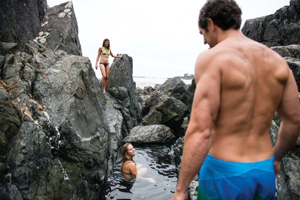
Located in Maquinna Provincial Marine Park, this is perhaps the most popular destination in Clayoquot Sound and visitors come via water taxis. You might want to plan your visit as a day stop and find anchorage elsewhere. Or arrive in the evening and leave early the next morning. To truly enjoy this natural attraction, visit in the off season. The boardwalk, containing planks from mariner’s boats, is a pleasant half-hour stroll through old-growth rainforest. You will know you are close when you smell sulphur. Geothermically heated water cascades into half a series of rocky pools. Find your temperature: the water in each successive pool is cooler and in the last mixes with ocean swells. There is a small fee for entering the park.
Nootka Sound
From Estevan Point it is 15 nautical miles to Nootka Sound, with no hospitable refuges. The Sound has many extended fingers worth exploring and Tahsis Inlet-Hecate Channel provide an inland route alternative to the open seas. The Village of Tahsis, with Westview Marina and Lodge, offers plenty of comforts and supplies, as well as an assortment of nature-based activities. Fishing is king at the Lodge and at nearby Moutcha Bay Resort, where comforts abound. The Mowachaht/Muchalaht village of Yuquot is located on the southeast corner of Nootka Island. The Nootka Island Trail extends from the village to the far side of the island. Critter Cove Marina in the NE corner of the Sound has cabins and is known for its friendliness and loyal customers.

Bligh Cove — Chart 3676 | 49 38.74 N 126 36.96 W
Most of Bligh Island and the nearby Spanish Pilot Group form Bligh Island Provincial Marine Park. The island has a rich First Nations archaeological history and is named after Captain Bligh of the Cook expedition. Bligh Cove is at the head of Ewin Inlet and is protected from all weather, with fair holding in 6-8 metres of water. The high surrounding hills are clothed in mature forests. Camping behind a beach with pit privy and fire ring. Kayaking among the numerous islets in the cove is excellent. During settled weather, there are several anchorages in the Spanish Pilot Group, where kayaking and marine life viewing are at their best. Visit or anchor also in Resolute Cove, where Captain Cook refitted the vessel which gave the name to the cove. Two plaques set in a rock cliff on the north shore commemorate his month in the cove.
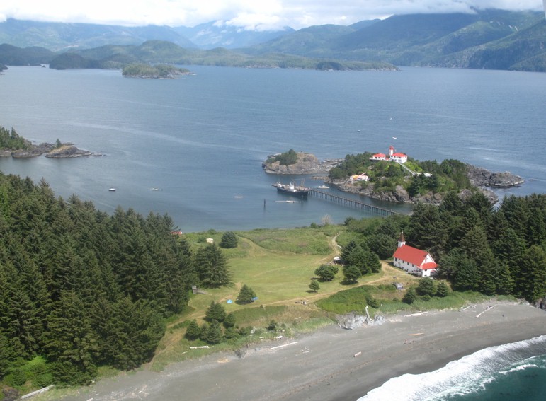
Friendly Cove Nootka Island — Chart 3675
The Village of Yuquot at Friendly Cove on Nootka Island affords an opportunity to experience First Nations culture and hospitality. For countless generations, this was a permanent settlement. It became a centre for trade between the Mowachaht/Muchalaht and European fur traders. It is worth going ashore and exploring history and contemporary First Nations culture. A landing fee is required (cash only), which gives you access to the Catholic church, beach, campgrounds, trail to the lake and the causeway that leads to the lighthouse, which is built on the former site of a Spanish Fort. Protected from W and NW winds, but exposed to easterlies. Anchor in 5-8 metres of water in good holding sand.
Hecate Channel, Esperanza Inlet, Nuchatlitz Inlet
We recommend that you visit Tahsis and then take Hecate Channel to Esperanza Channel and its sinuous finger inlets. You have a choice. You can cruise N to Zeballos where you can tie up at the public wharf and visit the general store. The other option is to cruise W along Esperanza Inlet. This area is worth enjoying for several days and there are many snug anchorages; so many you can have one all to yourself. We highlight just two anchorages, but put in a plug for Catalina Island Provincial Marine Park and the many anchorages in Nuchatlitz Inlet. We recommend the Dreamspeaker Cruising Guide for West Vancouver Island for more about this nautical paradise. Deep sea fishing and saltwater fly fishing off Esperanza and Nuchatlitz Inlets is unsurpassed.
Nuchatlitz Provincial Marine Park — Chart 3676
One of the most delightful Marine Parks, Nuchatlitz Park encompasses the very northwest tip of Nootka Island and many small island groups. The Park protects a number of archaeological sites, evidence that the area has been inhabited for millennia by First Nations people drawn to the region by the abundance of natural resources. These sites include ancient burial sites on and around Nootka Island, so use caution when exploring and ask for guidance if you stop in Friendly Cove. Nuchatlitz is an excellent place to study intertidal life, as many tide pools can be found throughout the maze of islets and reefs that make up the park. Bring your kayak! There are sheltered camping areas on some of the islands, but no facilities are provided within the park. Anchor near the head of the bay off the community site and near the oyster rafts. Good holding in 6-8 metres of water.
Queen Cove — Chart 3676 | 49 52.43 N 126 59.13 W
Located near the mouth of Eliza Harbour on Esperanza Inlet, Queen Cove offers excellent shelter, a variety of ecotypes, a river to paddle and several historical sites, including a cannery and remnant village. A good place to ride out north-westerlies and a popular stop when circumnavigating Vancouver Island. Anchor in 6-11 metre water with good holding mud and sand.
Kyuquot Sound
Another labyrinth of islands and inlets worth exploring and paddling for days. There are a dozen fabulous anchorages we don’t mention, but you which you will find in guidebooks. Kyuquot Village, home to the Kyuquot/Checleseht people of the Nuu-chah-nulth First Nation, has a bed and breakfast, motel, restaurant and general store. You are likely to see otters and sea lions in the Mission Group of islands just off the W entrance to the Sound, so we recommend a day visit.
Dixie Cove Provincial Marine Park — Chart 3682 | 50 02.68 N 127 11.00 W
Dixie Cove is located on Hohoae Island in Kyuquot Cove. The channel between Copp and Hohoae Islands has a minimum depth of 6 metres. There is a second, even more protected anchorage farther inside the channel to the west, with a mud bottom. There is room for 3-4 boats at each anchorage. The cove is surrounded by the park. There are no facilities for camping. We selected Dixie Cove because of its tranquility, warm inner waters (that’s relative) and its location near the heart of Kyuquot Sound.
Rugged Point Provincial Marine Park — Chart 3682 | 49 58.36 N 127 14.82 W
Rugged Point Marine Provincial Park is located on the E shore of Kyuquot Channel. The Park offers magnificent scenery, challenging hiking trails and some of the most picturesque white sand beaches on the west coast. Park amenities included a small day-use/picnic area with a pit toilet, bear-proof food cache and a cooking/picnic shelter near the beach. A popular spot for long distance kayakers. The beaches near the anchorage are connected to the Pacific-side beaches by a trail through old-growth forest. Find the trailhead along the eastern shore, which will take you as far as Kapoose Creek. Anchor near the inner beaches in 4-9 metres with good sand holding. Exposed to northerlies.
Big Bunsby Islands to Cape Scott
If you have ventured this far, you are ready for what lies ahead. From Kyoquot Sound until long past rounding Cape Scott, open ocean stretches of 25 nautical miles and more are the rule. The only remaining deep shelter is Quatsino Sound. Port Alice and Coal Harbour (in the Sound) and Winter Harbour (near mouth) offer supplies, accommodations, ecotours and fishing charters.
Bunsby Islands — Chart 3683
This group of rugged islands and islets is another place where you will want to linger for several days. Big Bunsby, closest to the mainland, is a Provincial Marine Park. The Park offers sheltered anchorages and excellent sea kayaking opportunities. Nature viewing is fantastic here with grey whales, bald eagles and the endangered sea otter all residing in the area. The Bunsbys are where the extirpated sea otter was first reintroduced between 1969 and 1972 and they thrive again. This is an excellent place to observe inter-tidal marine life, but pleased don’t touch and tread lightly when viewing this sensitive environment. There are four recommended anchorages — Scow Bay, Hollywood Cove, West Nook and Green Head Cove — all offering moderate to good protection, plenty of swing room and a decent bottom for setting the pin. A guidebook and chart are essential for safe navigation. The Bunsby group is best explored by kayak or dinghy.
Columbia Cove — Chart 3683 | 50 08.09 N 127 40.97 W
Located on the E side of Brooks Peninsula. White sand beaches and fantastically carved rock formations are part of the attraction. Approach from the E between Jakobson Point and the island guarding the cove (Protection Island). Inside you are protected in all weather and there is room for several boats. Along the northern shore, there is a large tidal flat and sand beach, with a backdrop of ancient forest and dark mountains, reportedly a good place to observe foraging bears, wolves and cougars. There is a half-mile trail which leads to a long white sand beach open to the Pacific Ocean. Extended shallow water near the beach means paying attention to tides when you kayak or dinghy in.
Quatsino Sound — Chart 3679, 3681
This is the northern most of the five sounds that epitomize the joyful exploration of Vancouver Island’s west coast. All three communities north of Zeballos are in Quatsino Sound. Like its sister sounds, Quatsino beckons boaters to stay and explore, rest and simplify. There are several recommended anchorages and it is difficult to select the best. We recommend Varney Bay (50 33.30 N 127 32.28 W) for its combination of protection and varied ecosystems including the Marble River Estuary. Varney Bay is deep in the Sound in Rupert Inlet and requires navigating Quatsino Narrows, which requires planning. Visit little Coal Harbour while you are nearby. Recommend also East Cove (50 29.86 N 127 50.59 W) close to the mouth of the Sound for its charm and protection. Everyone should stop in Winter Harbour to feel the heritage of an historical maritime community where they claim residents are few but there is lots to do. The Outpost and Harbour Authority provide everything a boater needs, including advice if you are planning on rounding Cape Scott.
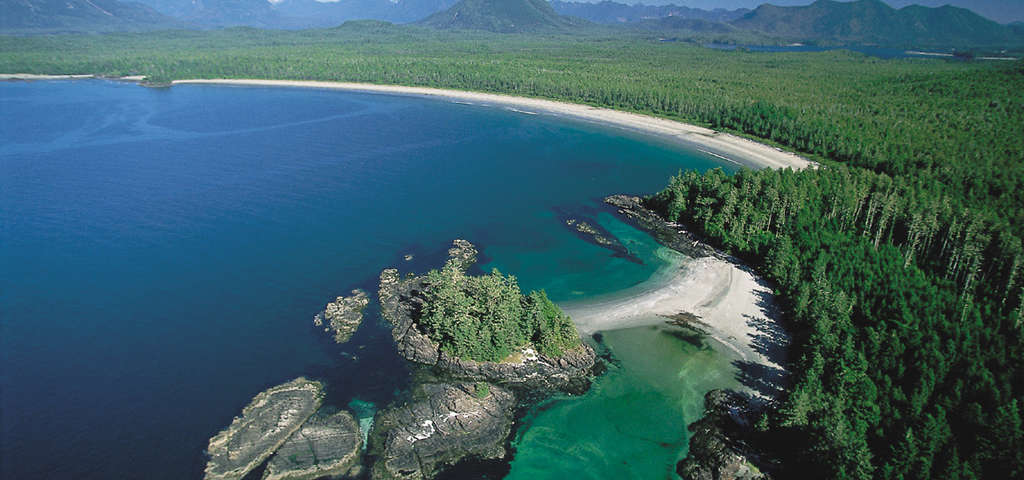
San Josef Bay, Cape Scott Marine Park — Chart 3624 | 50 39.50 N 128 19.00 W
This is the second-last over-night anchorage before the long run around Cape Scott to Hope Island. The relentless long Pacific swells reach even the deepest bay and going ashore to hike to Cape Scott trailhead or to Sea Otter Cove requires good timing. The fine sand beach, sea stacks and the characteristic pulse of swells striking low, rocky shores provide a sense of really being out there. And you are! Anchor on the west side of the bay no closer than a line between the western point and the outermost of two dry rocks at the eastern end of the large beach in 4-6 metres with good holding in sand. Sea Otter Cove (50 39.82 N 128 20.95 W) is just around the western point framing San Josef Bay. It offers better protection, except from southerly winds, but navigation through the entrance channel is tight.